
Feb. 14 – 28, 2022
After 10 years of promising, I finally made it to my brother Jim’s winter home in Arizona. Covid restrictions had me realize how quickly the privilege of travel can be taken away. On the flight I sat between two people from Bonnyville and my cousin sat in the seat in front of me. Small world.
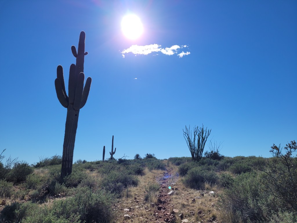
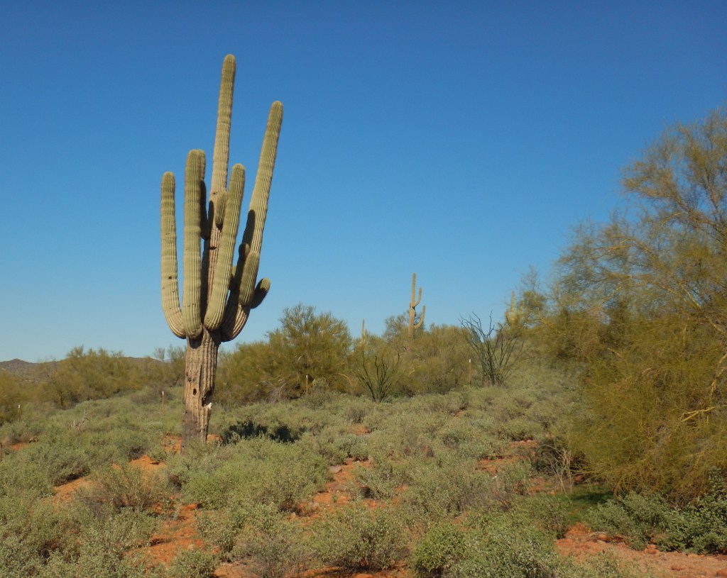
My first impression of the Mesa area was the saguaro cactus. Other than the modern buildings, the landscape looked right out of an old western. Saguaros are tall cactus with arms. They only grow at certain elevations and can reach 12 metres (40 feet) tall. They can live over 150 years, but don’t grow their first “arm” for about 75 years. Their woody vertical ribs help hold them up, which they need as they can weigh as much as 1500-2200 kg (3200-4800 lbs). It is a felony to damage one of these protected plants.
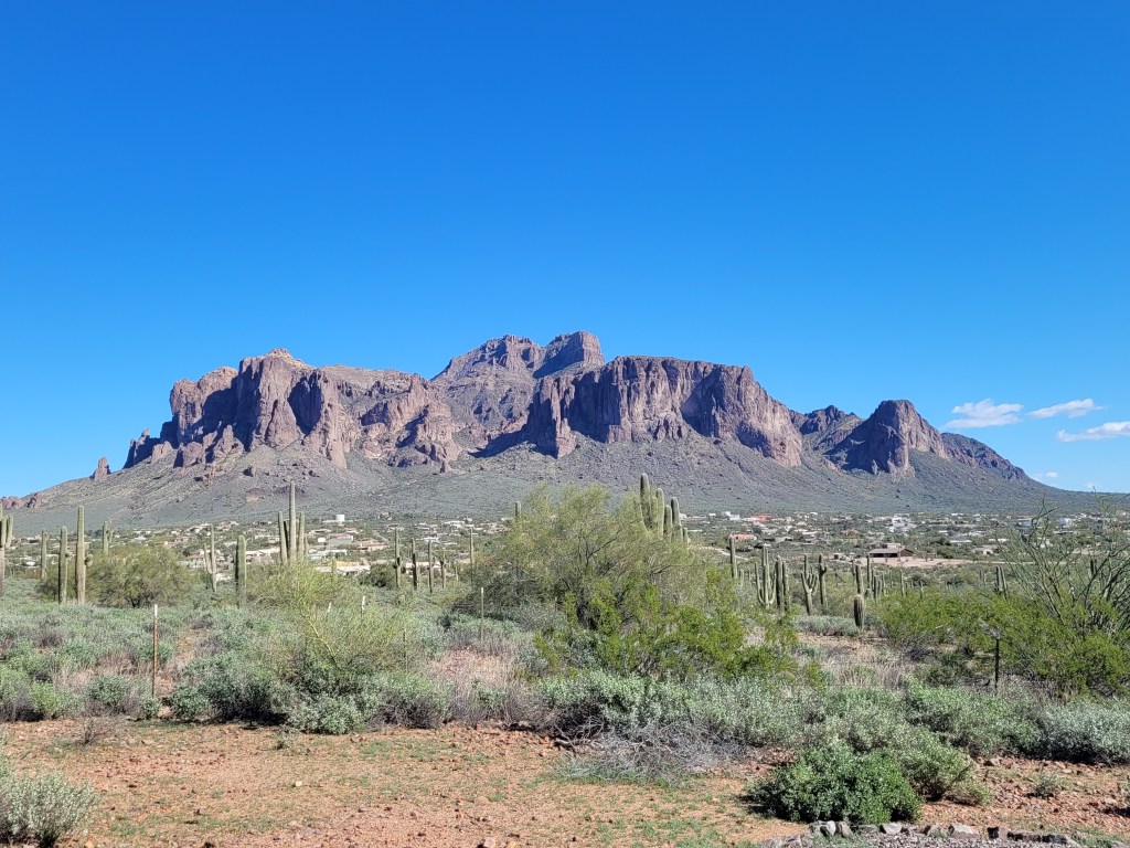
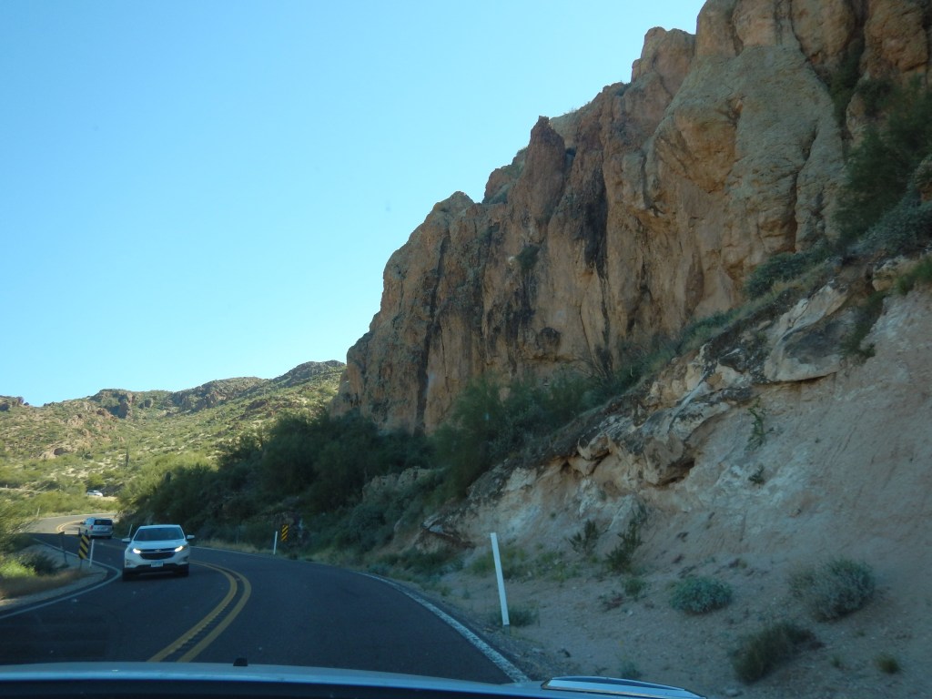
Jim pointed out Superstition Mountain, nestling Apache Junction, on the 20 minute ride back to his home. The mountain range is famous for the Lost Dutchman’s Gold Mine – a German immigrant claimed, on his deathbed, to have found the mother lode of gold which has had treasure hunters searching for it in vain for over 100 years. Its current fame is for a plane crash claiming the lives of 3 men and one of the men’s 3 young children. The top of the mountain has an upward sloping protrusion that looks like a ship’s bow called Shiprock peak. Witnesses say the plane missed this peak by several hundred feet.
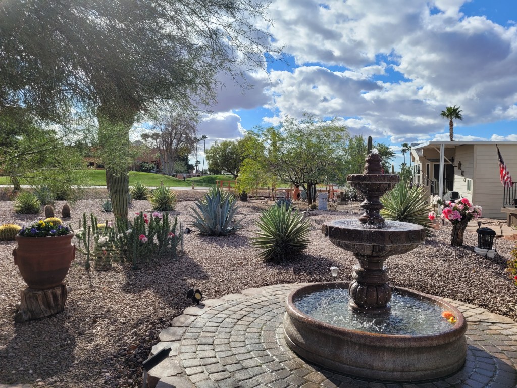
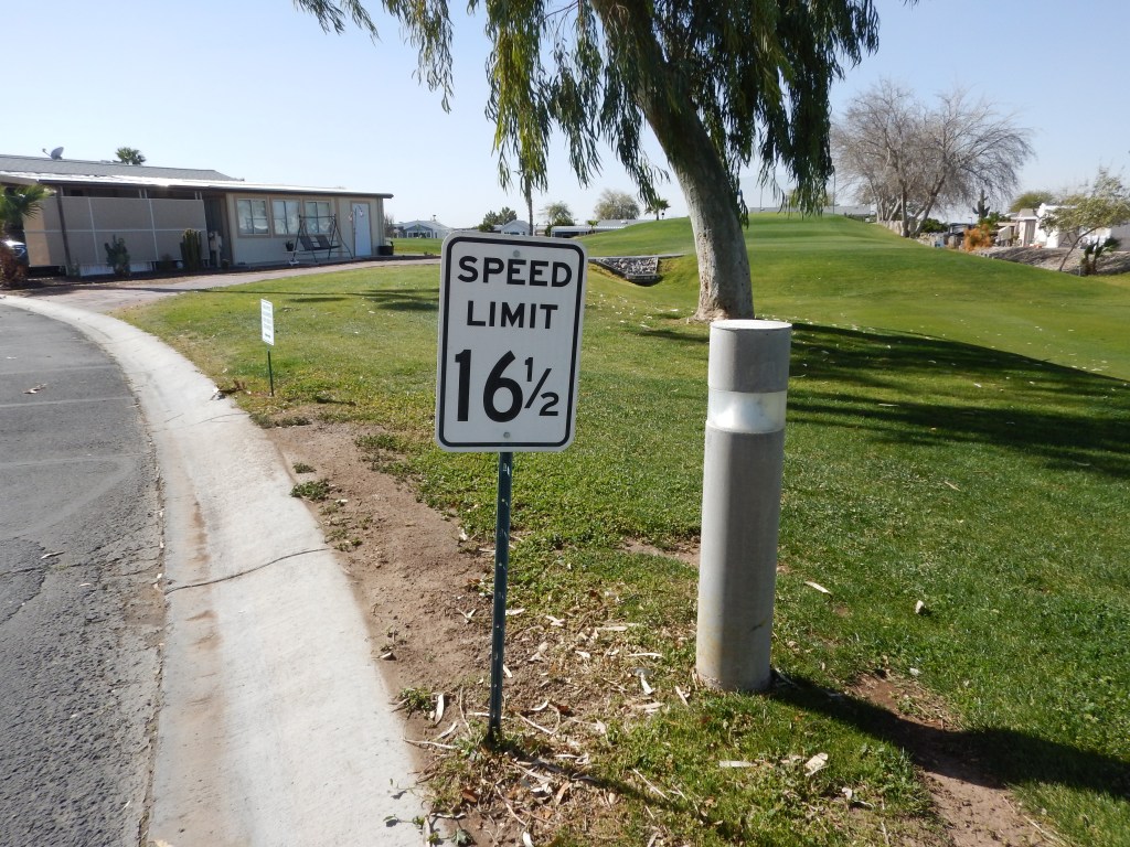
Jim and June have a park model home in Gold Canyon RV Resort. There are 750 homes in this particular resort, and they have the biggest and nicest site. Situated on a pie-shaped lot, it has a huge backyard. When they bought it the only landscaping was gravel. They have since planted many cacti and shrubs.
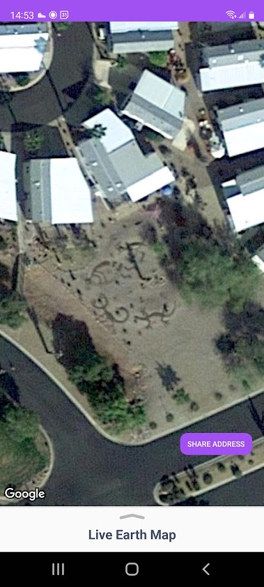
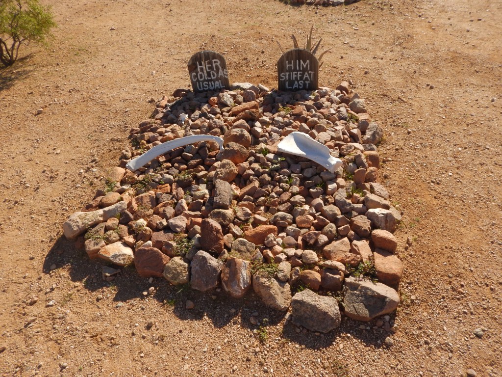
Jim also made a roadrunner, quail, Kokopelli, scorpion and lizard shapes out of coloured stones. He has plans for Wile E Coyote next. They are visible on Google Earth.
Directly behind the house, they placed patio stones and a huge water fountain. This is where the neighbours gather for happy hour or the ladies gather to stitch their Swedish weave blankets.
Everyone was expecting me! They welcomed “Jim’s sister” with open arms and a cocktail.
The next day, June took me on a walking tour of the complex and recreation centre. The rec centre was built with 1500 homes in mind. Since there are only half that number, the space is luxurious and spacious. They have a full workout room, billiards room, separate crafts rooms, a huge common area for TV events like the Super Bowl, a huge gymnasium looking room that I saw being used for a Murder Dinner Theatre event, a bistro and patio area for outdoor concerts. There is a swimming pool, about 12 shuffleboard lanes, and about 6 pickle-ball courts. The entire rec centre is surrounded by a 9 hole golf course. There is also a long wall with all the activities and events that one can take part in – everything from knitting to hiking. If you are bored at Gold Canyon – you deserve to be dead!! June’s twin sister, Joan, got me a guest pass.
The next day it rained and was quite cool, for Arizona. We couldn’t do much, so I went to the gym for a light workout, then June taught me how to play a couple of card games – Bitch Rummy and Golf. I caught on to Bitch Rummy pretty fast and proceeded to beat her. Over the course of the holiday, she really began to regret teaching me the game. LOL
The following day I went into Apache Junction to meet my 24 year pen-pal, Tom, for a coffee. After emailing and the odd phone call, we finally go to meet face to face. It was a lovely event and we promised to meet again next year when I return.
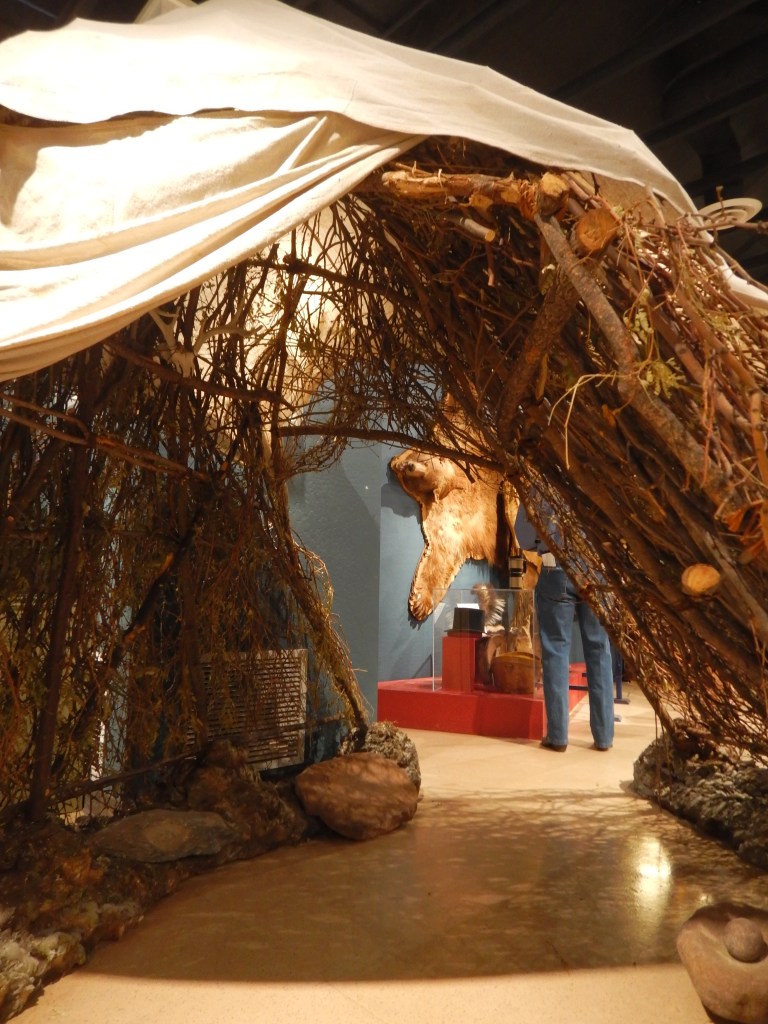
The afternoon saw nice weather, so I borrowed Jim’s SUV and Superstition Mountain Museum in Apache Junction. It covers 12 acres but is spread out. I went through the museum part ad learned some history on the native Indians that used to call this part of the world home. Most interestingly was the Wikiup shelter. It was built like an igloo but out of branches. The branches allowed the air to blow through and protected the inhabitant from the blistering sun. But it did not protect them from the thorns that often accompanied the branches. Western canvas was eventually used over the branches.
I also learned that the US government had a Camel Corp! In 1855 the government imported camels from the Middle East into Texas. Two years later an expedition set out across Arizona to California with camel-driver Hadji Ali (Hi Jolly). The onset of the Civil War brought the camel experiment to an end. Although camels were far superior to horses, the sight and scent of them scared the mules and horses. Soldiers were accustomed to horses and mules and a civil war was no time to be starting a camel training school. Most camels were sold off, to unknown outcomes. Some were released or escaped. The last camel sighting was in 1875.
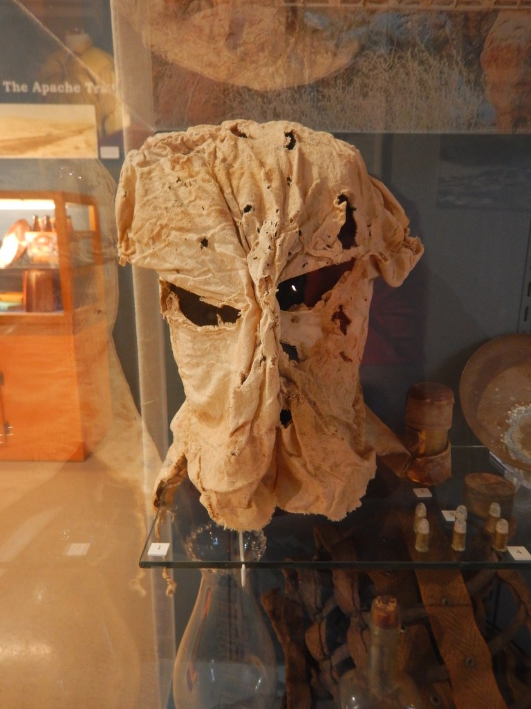
There were also old guns, fancy saddles, and stories of interesting characters of the day.
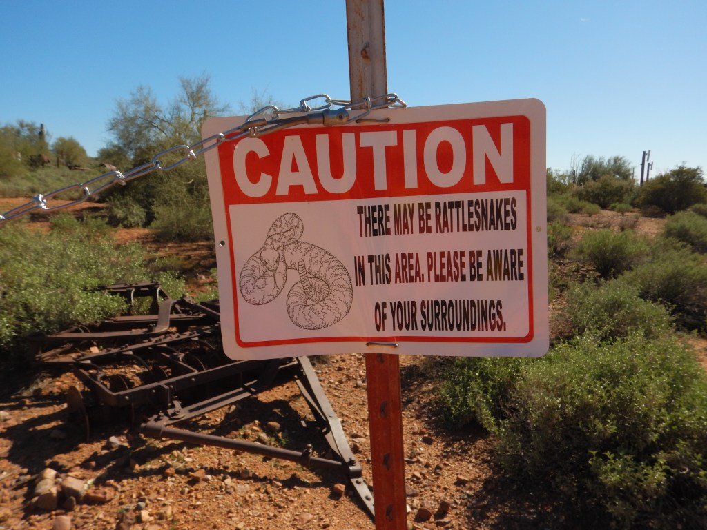
The Museum was hosting a Native American Indian speaker in the courtyard. I took the opportunity of the crowd being distracted to explore the buildings and grounds. It was mostly old buildings, gallows, and a comedic Boot Hill, depicting life as it was 150 years ago. There were a number of signs cautioning hikers to be aware of snakes, scorpions and other creepy crawlies.
I walked up a semi-groomed trail and found myself at the Ribbon of Life Monument. It is a monument to those who lost their lives in the Superstition Mountains through aviation accidents. A remnant of the plane that killed the family is there. I carried on about a half mile, enjoying the sights then made my way back.
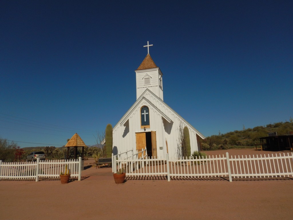
There is an old barn called Apacheland. It was a major building that served in many western films and TV westerns. (Think Bonanza) The original Apacheland Movie Ranch was built in 1959 as an 1800-acre movie set. A fire in May of 1969 destroyed most of the buildings, but it was resurrected and filming continued until another fire broke out in Feb of 2004. The barn and the windmill were the only structures to survive. They were both painstakingly moved to this location where they pay homage to their glory days of hosting stars such as Kenny Rogers as The Gambler, Richard Boone in Have Gun Will Travel, Barbara Stanwyck in The Big Valley, and Elvis in Charro. The small church, located nearby, is the Elvis Chapel. There is a huge statue of Elvis at the front and it is still used as a wedding chapel.
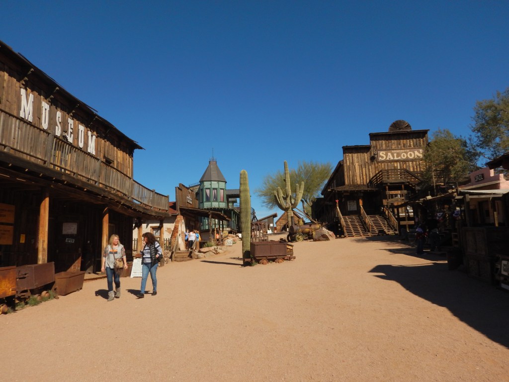
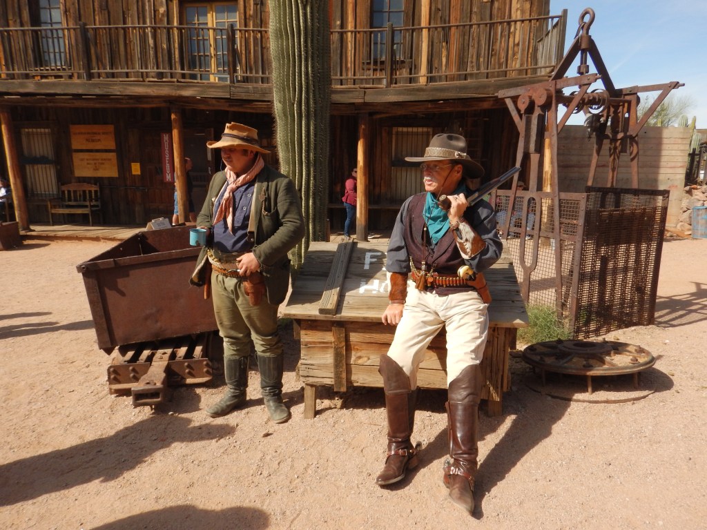
The following day Jim and June took me to Goldfield Ghost Town. It is just a half mile down the road from the Superstition Mountain Museum. It is set up as a proper old Western Town from the 1890s with lots of general stores, a jail, church, train station (that offers rides), a copper mine (tours for a fee), a brothel, and lots of bars.
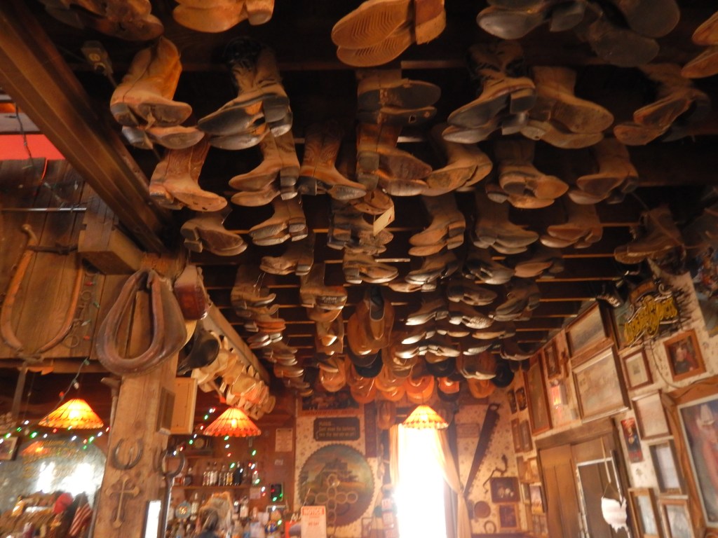
We wandered into all the shops and I bought a few trinkets. One of the bars had old cowboy boots hanging from the ceiling. The barman said we were welcome to sit and have a drink as long as we weren’t BLM, Antifa or a Democrat. We were none of the above, but we didn’t stay for a drink either.
Jim and June wanted to take me to Tortilla Flat, an authentic remnant of an old western town located along the Apache Trail. It was originally a camping ground for prospectors, then a freight camp and a stagecoach stop for the construction of the Roosevelt Dam in 1904. In 1942 a flood chased most of the less than 100 population away (current population: 6). A farmer purchased the town in 1998, which is primarily a small store and restaurant. It also has a post office and a voter’s precinct, making it Arizona’s smallest official community. Several hiking trails into the Superstition Mountains begin near Tortilla Flat.
We drove along a crazy crooked road full of switchbacks, steep cliffs and threatening boulders waiting to fall. It was a beautiful drive, and I am glad it was not me behind the wheel. We finally reached Tortilla Flat only to discover that there was NO parking available. For a little place in the middle of nowhere, it sure was busy. There was a lineup waiting to enter the restaurant/bar. It looked like Boxing Day shoppers in the desert. I did notice that a burger was $15. We turned around and went back home.
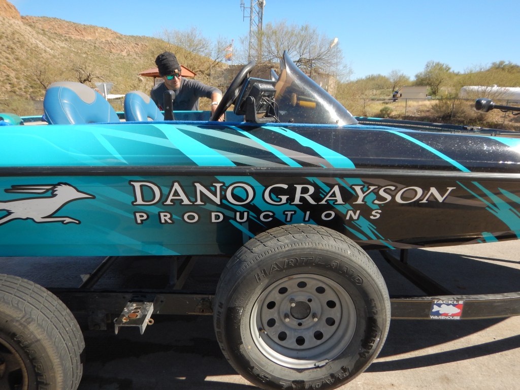
On the way back home, Jim wanted to stop at the Dolly Steamboat. We missed the turnoff and ended up at the boat launch to Canyon Lake. There were bathrooms so we figured while we were here and they were available…. Jim and I walked down to the lake and we met a fellow who was winding up a cable connected to a submarine drone. Jim asked him what he was doing. Long story short, Dano Grayson is a photographer with National Geographic. Since his trip taking pictures of bats in South America got cut short due to Covid, he decided to come back to America and film freshwater fish. He explained that fish accept his submersible drone as a weird-looking fish and don’t scatter like they do when humans try to blend in. Very cool!
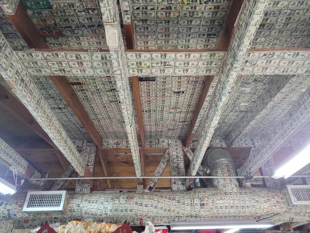
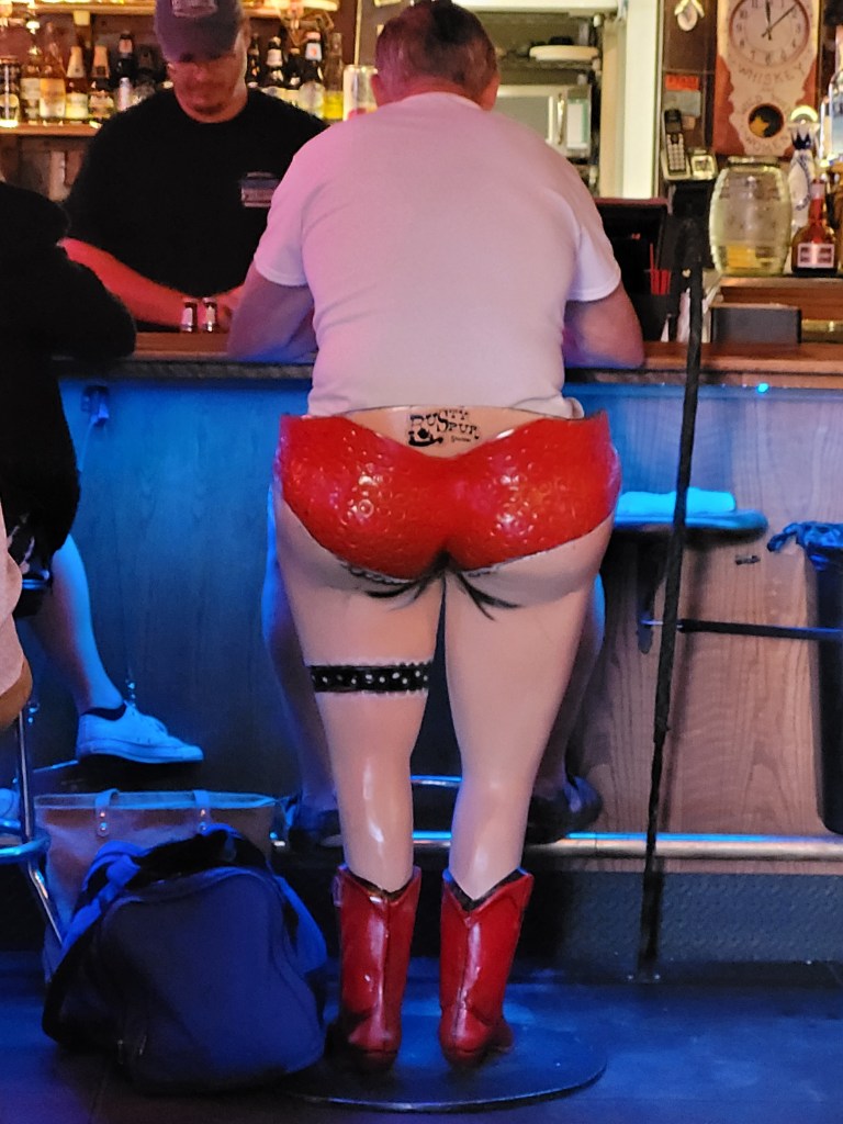
When we got back to Apache Junction we stopped for lunch at The Hitching Post bar. The walls were papered with dollar bills. I found this to be a theme throughout Arizona bars.
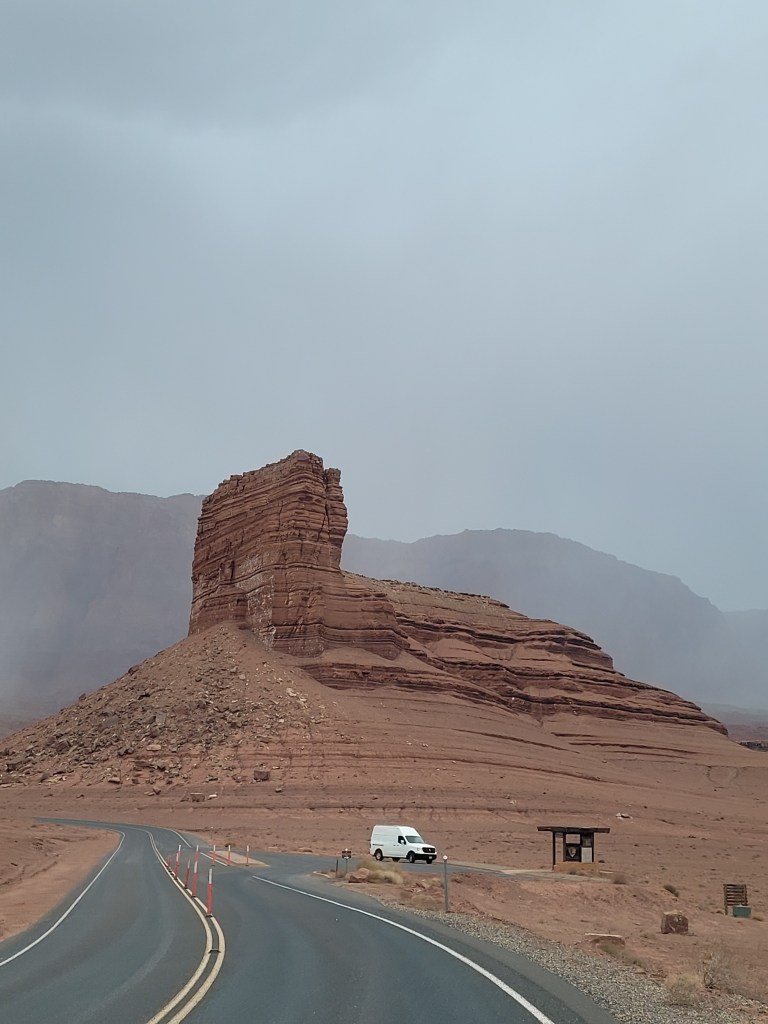
The next day (Saturday, Feb 19) Jim drove me to the airport, where I got a car and started my road trip of Arizona. I headed straight to Sedona. The first thing that struck me was the red sandstone formations. Bell Rock, in particular, is kind of hard to miss. It seemed like I was going to drive right into it as I passed through town. It is, as the name indicates, bell-shaped – wide at the bottom and tapering upwards to its 4919 foot summit. There was a scenic pull out where I stopped and had some pictures taken. I noted that there was a hiking trail, in hopes of coming back the next day. ( I never did.)

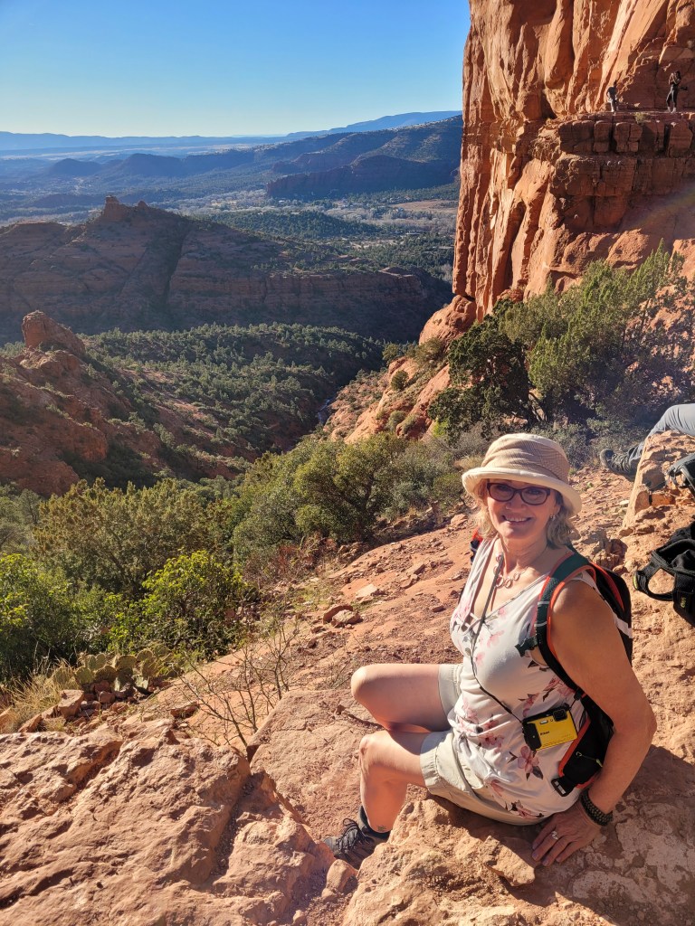
The formation that really caught my eye was Cathedral Rock. It has formations that rise up like the spires of a cathedral. I was more intrigued with climbing this one. The road leading up to the trailhead was blocked. The guard said there are only 50 parking spots for hundreds of people wanting to climb. I parked in a church parking lot and walked the mile up to the trailhead. It was getting close to sunset and the guide said this was a good hike and view for this time of day.
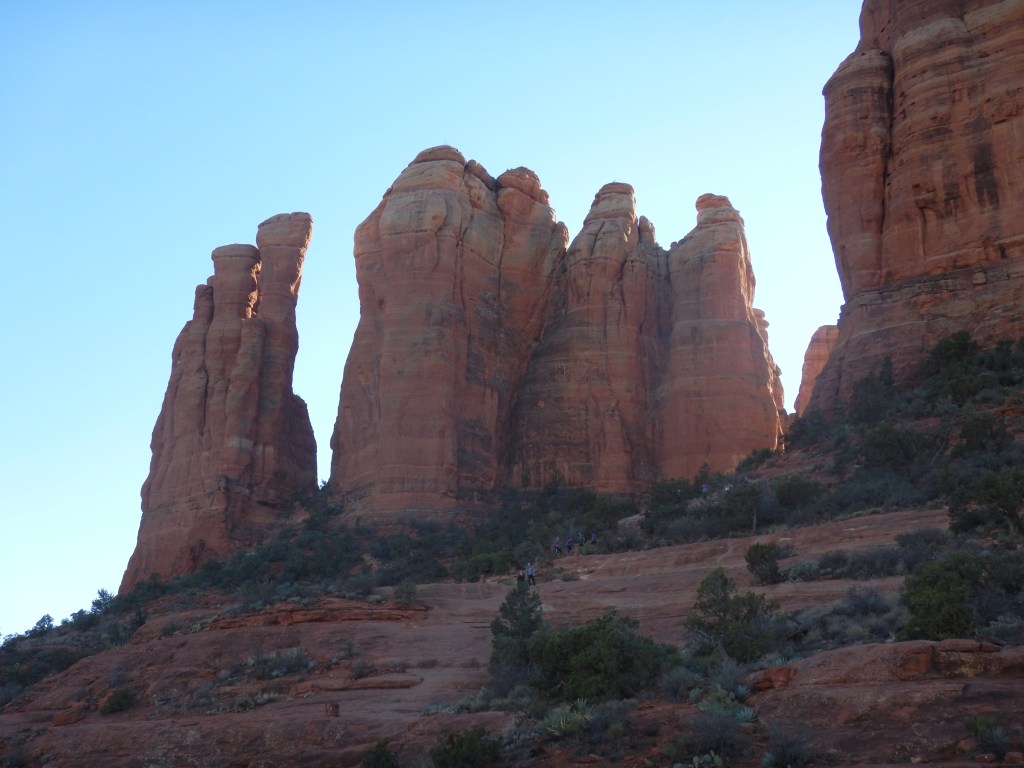
The trail is rated as moderate. It is only 1.5 miles (2.4 km) round trip but has an elevation gain of 740+ feet (226 m). In places, it is nearly vertical and I had to scramble up on all fours. It took me about 50 minutes to climb. I nearly quit at one point, when I realized I have to get back down!! But some young fellows said I was nearly at the top and that I would be happy that I went all the way. The did not lie. The view was incredible and the sense of accomplishment, for a 64 year old, was undeniable. The hike down was indeed tricky. It was almost easy to scramble up, but going down required some butt-scooting. Thankfully, a gentleman going ahead of me always stopped to offer his hand, lest I slip.
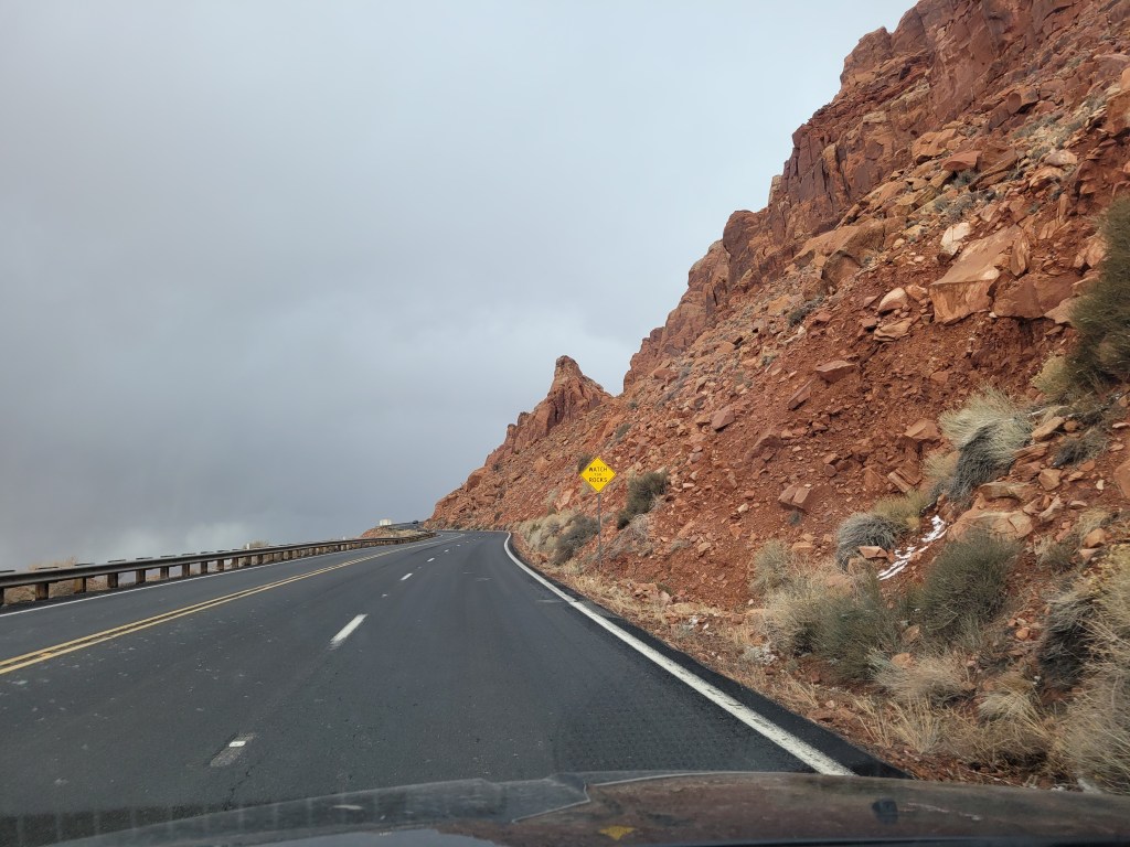
The next day I headed toward Las Vegas. The drive was long but scenic and interesting. I ran into some snow and lots of tumbleweeds. I even saw some wild horses. All along my trip, I was amazed at the rock formations. The rocks looked like they would just slip apart. They were stacked precariously with no pattern to the layers. This entire area was once an ocean bottom. Sand moves this way and that under the water. As the ocean disappeared the layers of sand compressed into these weird shapes. It was also obvious that the rocks do slip apart from time to time. There were huge boulders balancing along the slopes crowding the road. Considering that I ran into snow, and knowing ice could form under these boulders and make them slick then slide down onto the road, was not comforting.
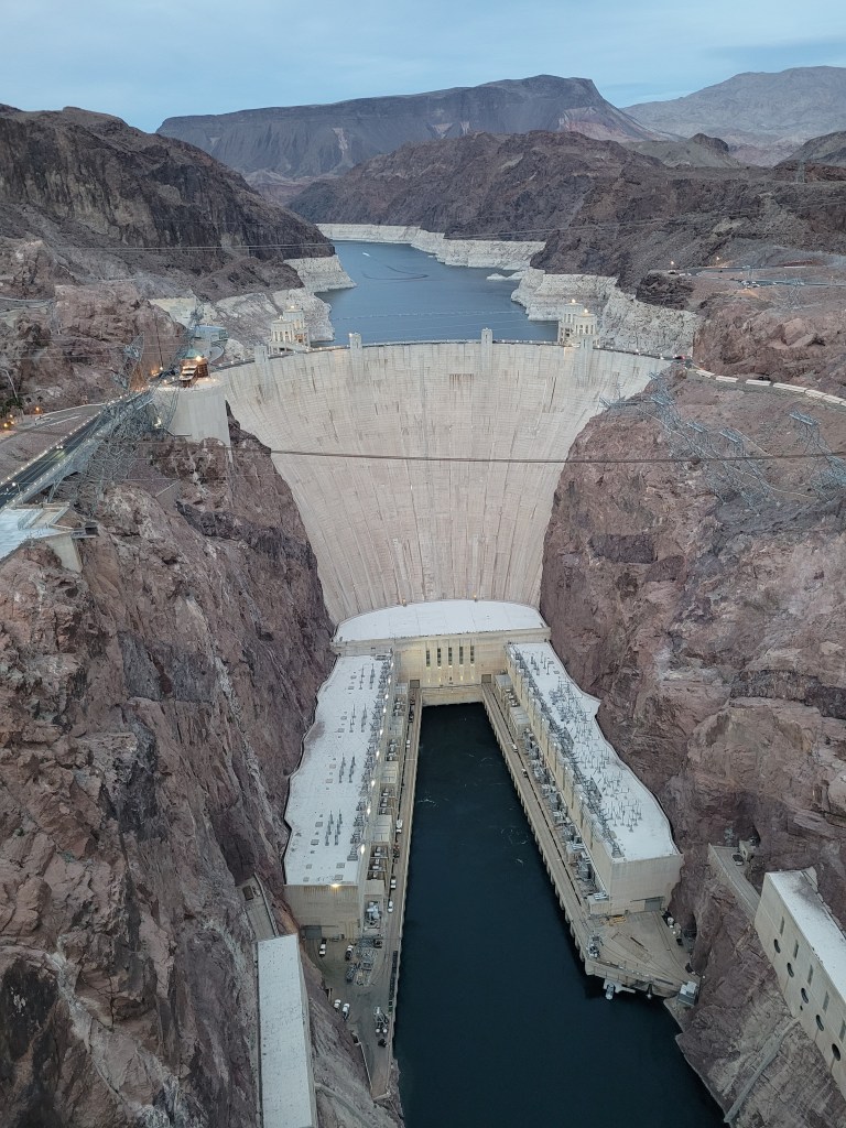
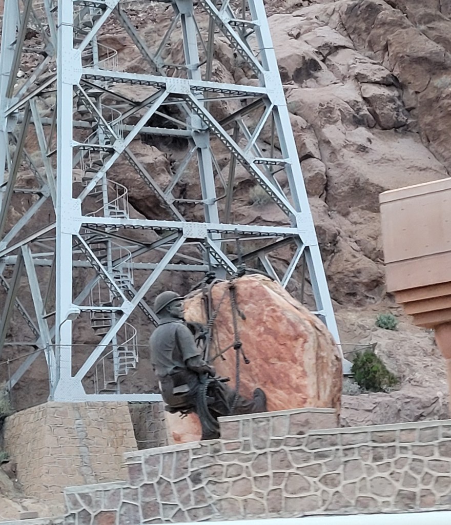
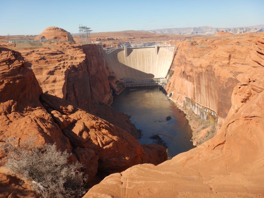
I couldn’t pass Hoover Dam without stopping. A dam was talked about since 1900 in response to control the flooding and droughts that wreaked havoc on lands bordering the Colorado River. It was constructed between 1931 and 1936; a make-work project during the Great Depression. It was completed 2 years ahead of schedule. Thousands of workers working 363 days a year were employed. You read the right, they got 2 days off a year! 96 died in the building of the 726 foot (221 m) structure. This number does not include the deaths that occurred due to pneumonia – which was alleged to be a cover for the carbon monoxide poisonings from gas fueled vehicles in the tunnels.
The town of Boulder City was constructed for the workers. It housed 5000 workers, with a peak population of 7000. Las Vegas, at the time, had a population of 5000. Workers were paid well. The average wage, at the time, was between $0.42 – $0.52 per hour. Dam workers were paid $0.50 – $0.75 per hour. Some of the very dangerous jobs (making sure the tunnels were safe for crews after blasting) were paid as much as $1.00 per hour. High scalers was another dangerous job. One worker said “they hired anyone who didn’t have brains enough to be scared. You was 900 feet up in the air. It took a lot of guts.” Suspended from the canyon rim, they used jackhammers and dynamite to remove loose rock from the canyon walls. They got paid $0.70 per hour.
Some of the building techniques were unproven. For example, it was estimated that if the 3,250,000 cubic yards of concrete were poured in a continuous pour, it would take 125 years to cool, causing the dam to crack. Therefore, steel pipes were placed at regular intervals throughout the pouring that had river water, chilled by a specially built refrigeration unit, running through them. When the cement had cured and had stopped contracting, the pipes were filled with grout.
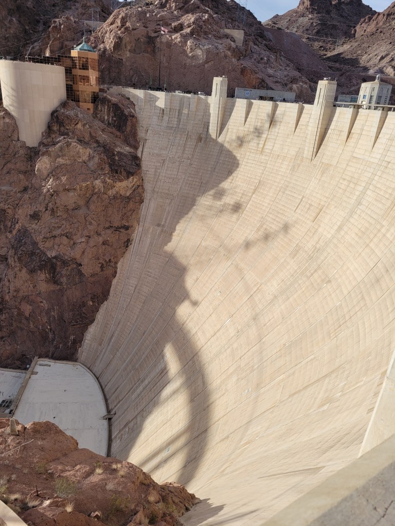
The dam is 1244 feet (379 m) across the Black Canyon and is 660 feet (201 m) thick at its base. It produces 4 billion kilowatt-hours of electricity per year, enough to serve 1.3 million people. No tax dollars are used to operate Hoover Dam. Operating costs are paid with revenues from the sale of electricity as well as tours.
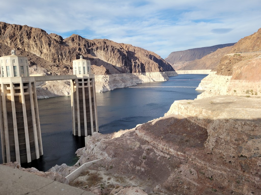
Lake Mead, technically the reservoir of Hoover Dam, covers 247 sq mi (640 sq km). It is currently at only 35% of its capacity, which is the lowest it has ever been. The last time it was this low was in 1937 when the water managers were still filling the reservoir and putting the finishing touches on the Dam. The white “bathtub ring” on the lake’s shores marks the drastic drop in water level. There are two overflow spillways, which have only been used twice; the first time was a test, the second time during a flood in 1983. The water has dropped 153 feet (46.6 m) since then. It now has 1071.5 feet (326.5 m) of water. The generators cannot work if it drops below 950 ft (289.5 m) and millions of people will be without a reliable source of water.
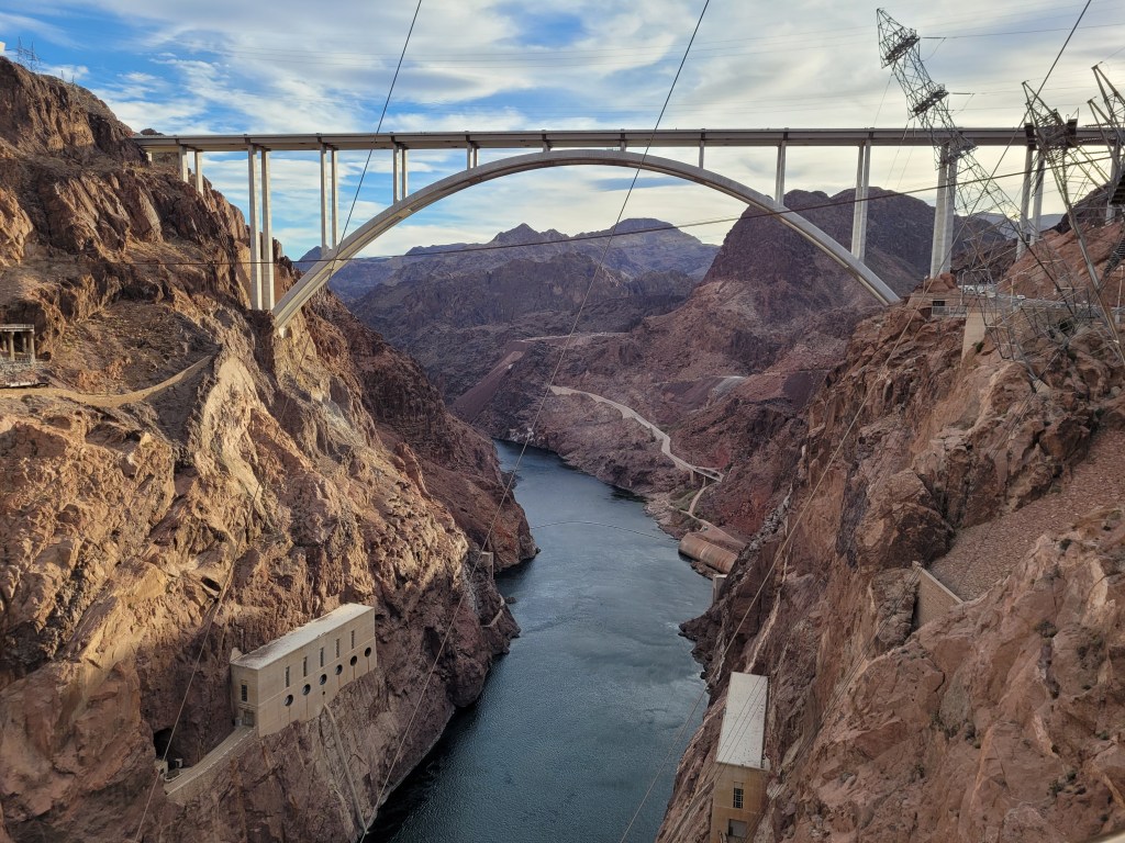
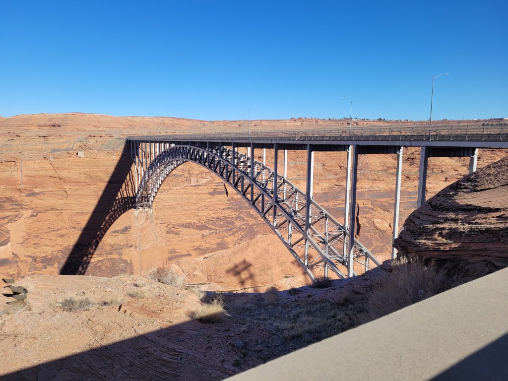
Traffic used to cross the Colorado River, between Arizona to Nevada, along hairpin turns and blind curves then along the rim of the Hoover Dam. The route was dangerous and inadequate for the rising volumes of traffic. As well as people rubber necking to have a look at the Dam. The decision was made in March 2001 to build a new bridge. The Sept 11 attacks of that year cemented the idea. It was just too risky to have some nut-job try to bomb the Dam. The Mike O’Callaghan-Pat Tillman Memorial Bridge was built 150 ft (460 m) downstream of Hoover Dam. It is a beautiful structure that has the widest concrete arch in the Western Hemisphere and is the world’s highest arch bridge. It was getting close to dark when I took the walk out onto the bridge. It was really windy and I was thankful for the high cement railing. I walked only half way and got a beautiful picture of Hoover Dam. By the time I walked back, the gates were closed and I was glad I parked across the road and was able to leave.
I drove toward Las Vegas. At a major junction, there was a huge truck stop and casino. Railroad Pass Casino and Travel Centre. I pulled in for some gas and realized that people were camping out in their vehicles. I talked to a young couple from Poland (they were beside themselves when I said a few words of greeting in Polish!) They said they were travelling across the USA and sleeping in truck stops from the back of their truck. Well, if they could do it, so could I! It turned out to be one of the best pieces of advice I ever got. Truck stops have showers, toilets, groceries, and discounted coffee if you have your own thermos. Beats the hell out of an expensive hotel.
SIDE NOTE: Gas was 5 cents per gallon cheaper if I pre-paid cash.
Roland and Joanna said they had been travelling around the world for 3 years with a project called “WorkAway”. They work for room and board all over the world. The vehicle they had was on loan from their last employer. They had 3 months to bring it back. I need to look into the project!
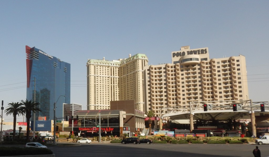
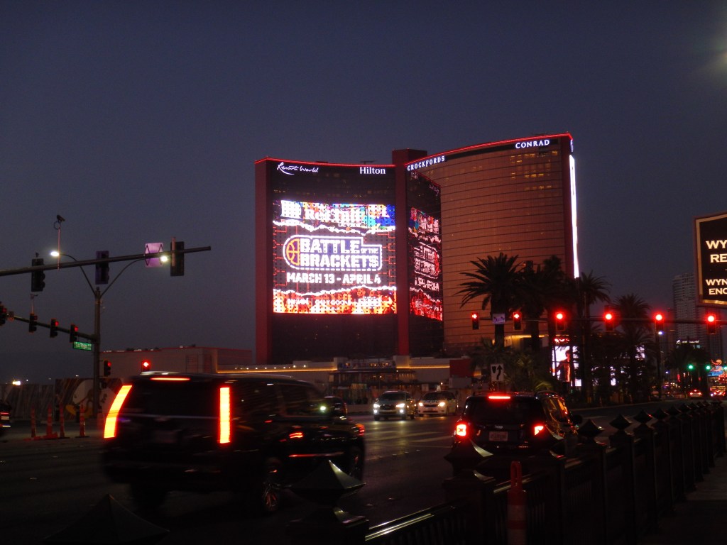
It was now Monday and I headed for Vegas. It was much bigger than I had imagined. I always thought the Strip was about 5 blocks long. It is 5 miles long. I drove up and down looking for a place to park. Finally, I Googled and found a hotel that had paid public parking. The girl at the front desk said to pull into the parkade, pull a ticket, then pay upon leaving. Perfect.
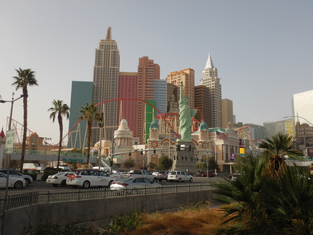
I was only a few blocks off the strip. I started my adventure at Circus Circus. I walked up one side of the strip and down the other. I went into all of the major casinos and hotels. The casinos are all the same; lots of slot machines blinking and beeping. What I found amazing were the actual hotels. Each had its own themes. The Venetian had real gondolas.
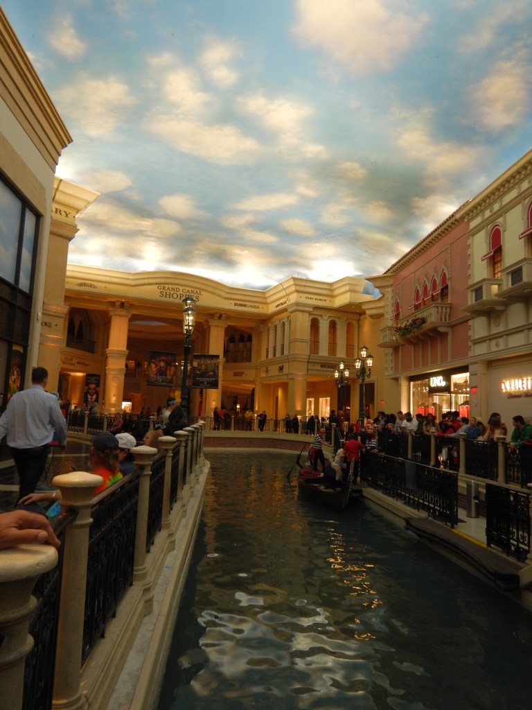
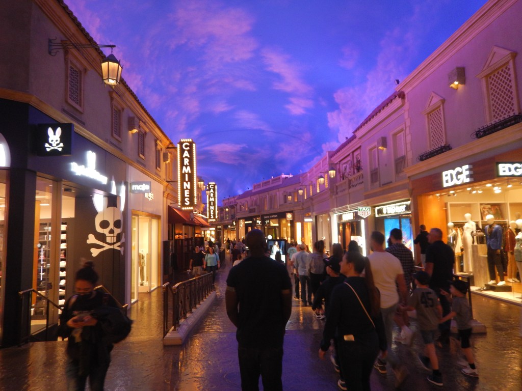
Caesar’s Palace had Roman statues. The Luxor had Egyptian motifs. The hotel shopping malls had stores like Gucci, Chanel, Dior, Fendi, Louis Vuitton, Prada, Tiffany, Valentino. Not a Winners or TKMax to be seen. The mall ceilings were painted to look like a sunny sky with a few puffy clouds. It was so realistic, it played tricks on the senses.
These hotels are HUGE!! Vegas has 150,000 hotel rooms. The MGM Grand, alone, has over 6000 rooms. I can’t remember which hotel I exited, thinking I would be back on the main street, but I ended up behind the hotel. No worries, I’ll just walk around it and get back to the front. A good half-mile and 30 minutes later, I finally made it to the street.
I had lunch at Wahlburgers, a burger place owned by Mark Wahlberg and his brothers. The burger was good, the price was expensive. Enough said.
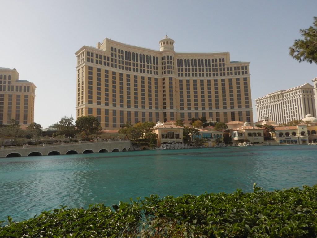
I had hoped to see the water show at the Bellagio, but it was crazy windy with huge garbage cans blowing up the street, so the water show was cancelled.
It was getting dark by the time I was finished. I headed back to the car. I tried to insert my parking stub into the machine, but every time I did, it would not accept it. There was a car behind me so I motioned that I was going to back up to let her past. She got out of her car and attempted to open the electronic arm with my stub. Nada. She was a guest at that hotel so she used her door card to pass through, then she ran back up the ramp and tapped her door card again to let me through. Sweet. I saved $16. I drove back to the truck stop from the night before.
Somewhere along the drive, I got a big rock chip in the windshield. I decided to get it fixed, rather than let it spread and become a huge problem. I Googled one place and they were closed. Another place, nearby said they could call someone from Vegas to meet me in an hour. No thanks. I Googled another place right in Vegas. I drove there and they were able to fix the windshield right away. $45 later, I was good to go.
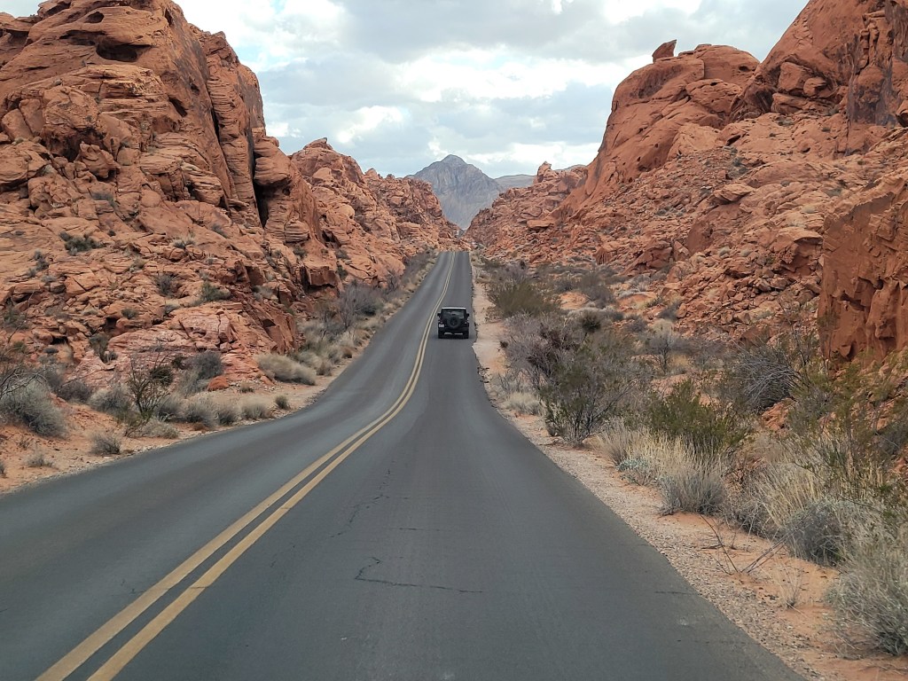
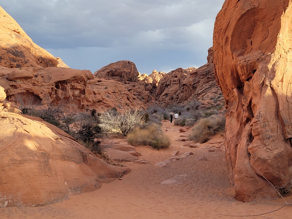
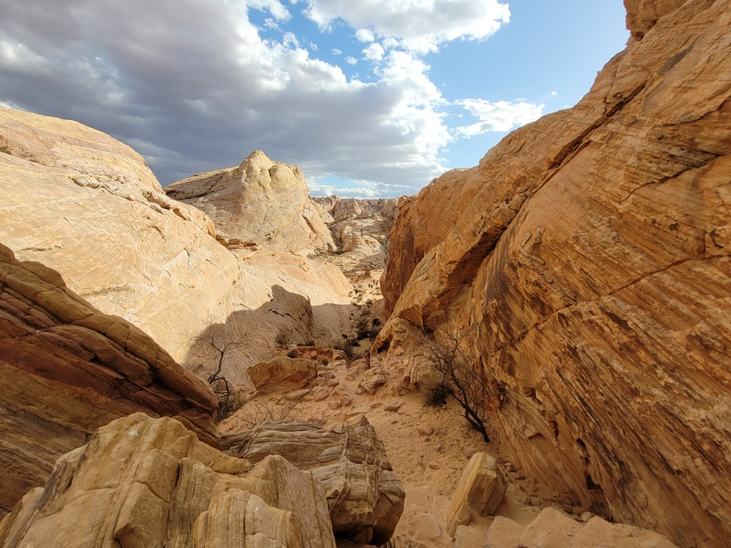
I was headed to Butte Canyon. Along the way, I spotted a sign that said Valley of Fire. That sounded familiar and interesting so I detoured off the main road and set my sights for the Valley of Fire.
The visitor centre was nestled beside some crazy huge red bluffs that had massive holes, some big enough for me to hide in. The road past the centre was a contrast of new black pavement dissecting 150 million year old brick-red sandstone.
The sharp bluffs gave way to lumps of brownish sandstone that looked like huge piles of dried mud.
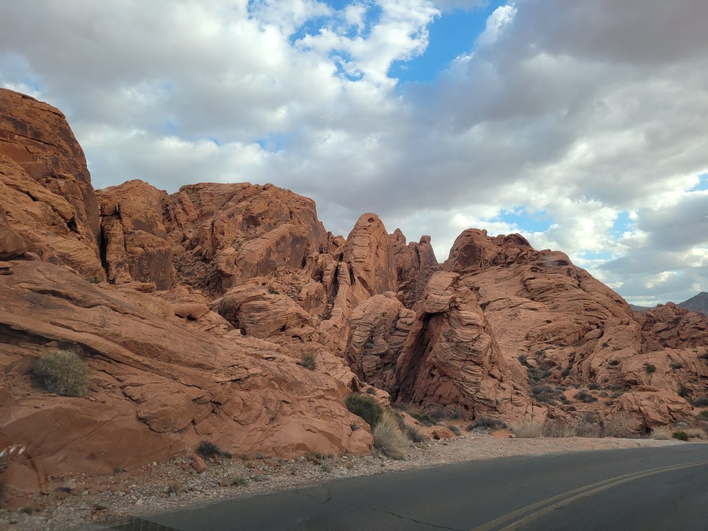
That landscape gave way to white and tan sandstone that indeed looked like the bottom of an ancient sea and shifting sand dunes.
One could see 3 very distinct different colours of sandstone in the same rock or ridge. It was amazing. I never saw anything like it before. It was wild and primitive.
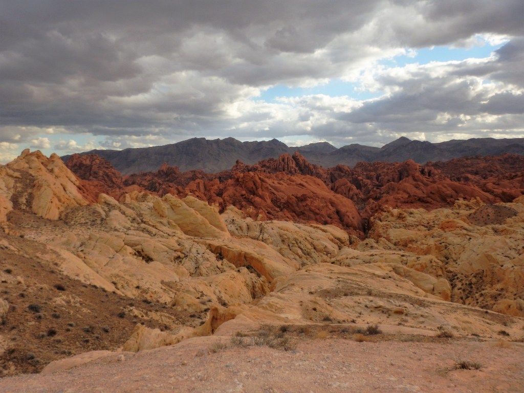
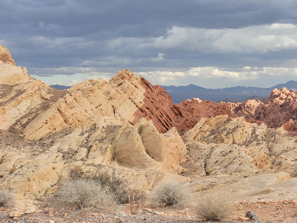
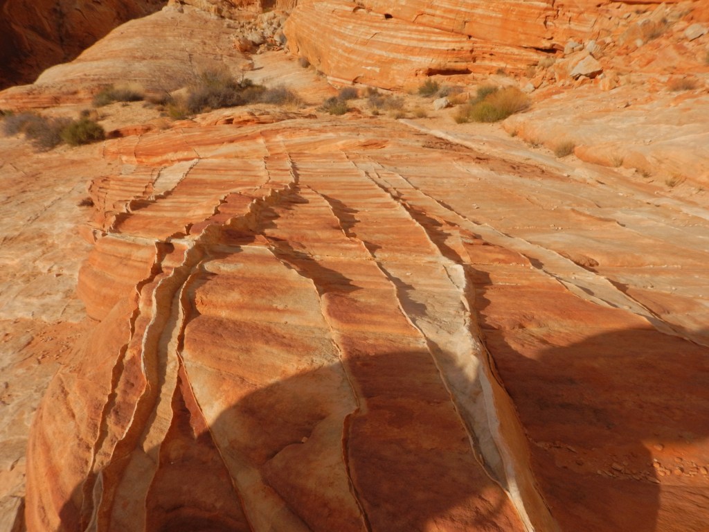
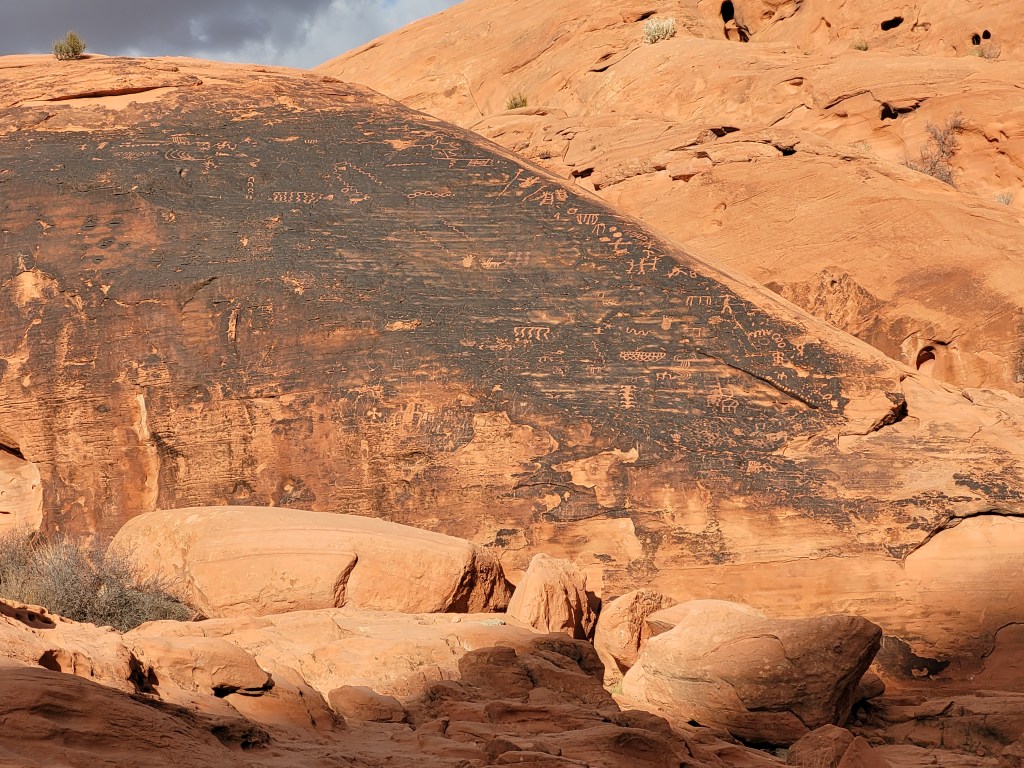
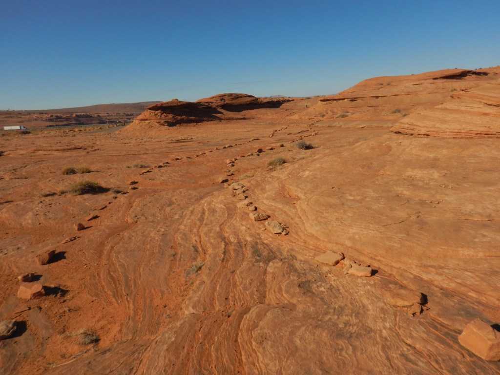
The deep red is caused by the rusting of iron, which became white as the iron leached out. The rock faces with black were a result of iron and manganese leaching out and evaporating. These black rocks are what the first inhabitants carved petroglyphs into. Chemical changes created the bands of pink, lavender, burgundy, purple, grey, yellow and green. Water and wind constantly wear at the irregular cementing of grains of sand. This is what causes the domes, arches, potholes, hollows and ridges. Some of the ridges look like icing being squished out from between the layers or a cake.
There are many hiking trails in the park. There were signs cautioning hikers signs to be careful. Everything in the desert bites, pokes, or stings! There were posters asking hikers to be on the lookout for a man who went missing last year.
I went on two hikes. The first was the White Dome loop, a 1.25 mile (2 km) loop over loose sand and rough terrain. Highlights included a slot canyon and the remains of an old movie set. (The Professionals. Electric Horseman. Star Trek Generations)
The second hike was the easy .75 mile trail Mouse’s Tank. The highlight here was the 2000 year old petroglyphs. I spent a few hours hiking then decided it was time to head to Butte Canyon.
As I headed east, the weather was getting noticeably colder, with ominous clouds forming. My trusty GPS started to take me to Butte Canyon. My spidey-sense was telling me not to go. Although the GPS said it was 50 km away, the timeline said it would take me 90 minutes to get there. Sounded like a goat trail to me, or at least too many switchbacks for my liking. Also, the weather was getting colder. I made the decision to scrap Butte Canyon for now, and I headed to Mesquite, NV. I spent the night in another truck stop only to wake up to snow on the vehicle and a temperature of below zero!
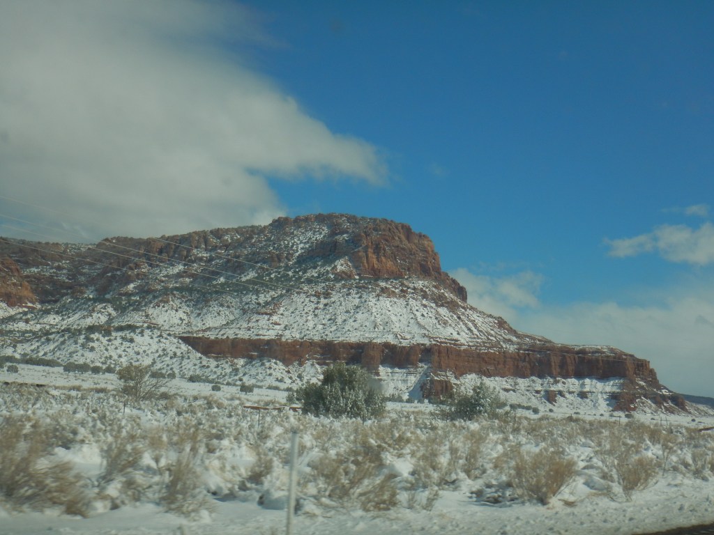
After a shower and a coffee, I totally scrapped the idea of Butte Canyon and began to head toward Page, AZ where I had a reservation to go on the Antelope Canyon tour the next day. The road took me past Zion National Park and Vermilion Cliffs – both of which I wanted to see and hike. I got a few pictures of the Vermilion Cliffs from the vehicle and pull-outs. They are indeed vermilion in colour.
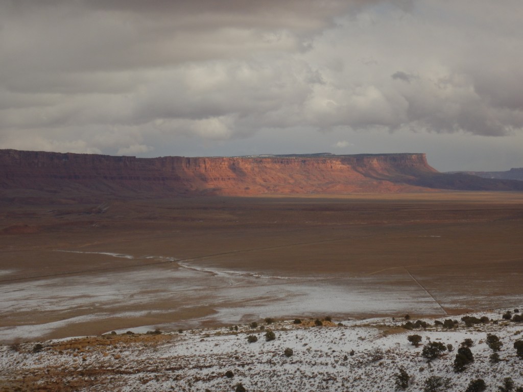
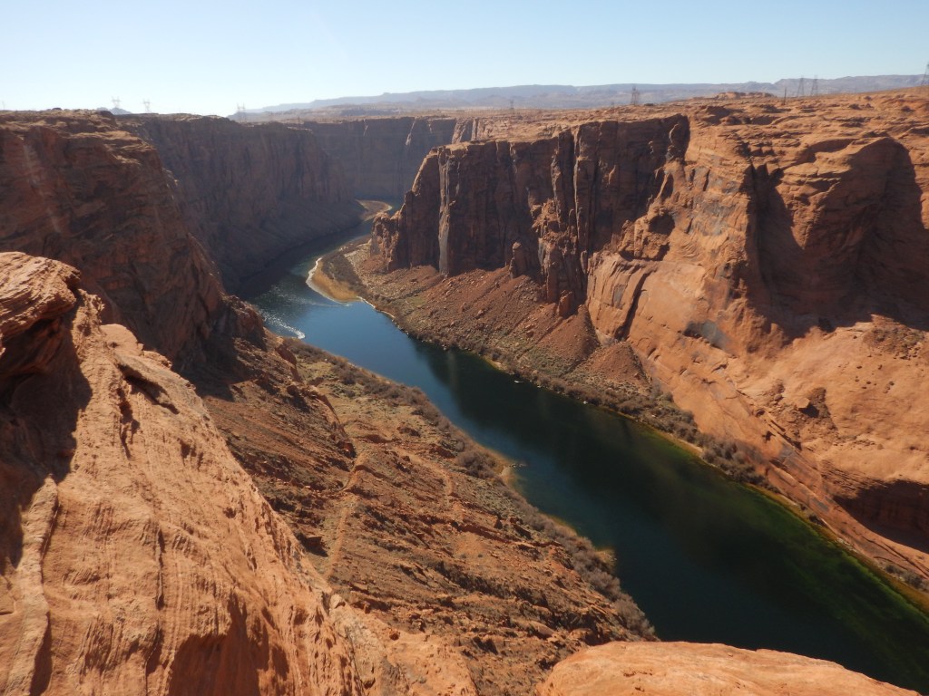
Lee’s Ferry Entrance Point had a sandstone wall that seemed to stick out of the surrounding area like a broken down sphynx.
But with approximately 6-8 inches of heavy wet snow recently pushed off the highway and a temperature of minus 3 C, I kept on driving. I stopped for a short break at Jacob Lake Inn where I met a girl who assured me I was on the right road. As I drove away, I noticed a gate that said Grand Canyon North Rim – Closed. I met some people who left Nevada earlier that day and they said there was at least a foot of snow on the roads. I was lucky I waited until the snowplows had cleared them. I am also lucky I did not go to Butte Canyon. I’d still be stuck there! With a total of 192 miles (309 km) on mostly wet switchback roads at an elevation of 7000 ft (2134 m), I was ready for a hotel room.
The TV in the hotel room did not work, so I got a discount. I did my laundry in the hotel facilities, collected some food and supplies from Walmart, relaxed in the hot tub across the hall from my room and had a fantastic sleep.
SIDE NOTE: The TV was on in the complimentary breakfast dining area of the hotel. All eyes were glued to the news of Russia invading Ukraine. Thursday, 24 February 2022
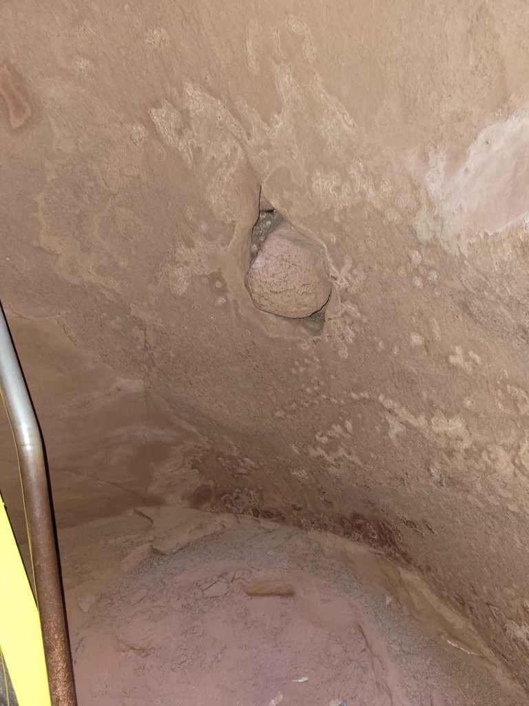
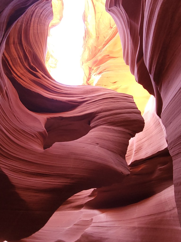
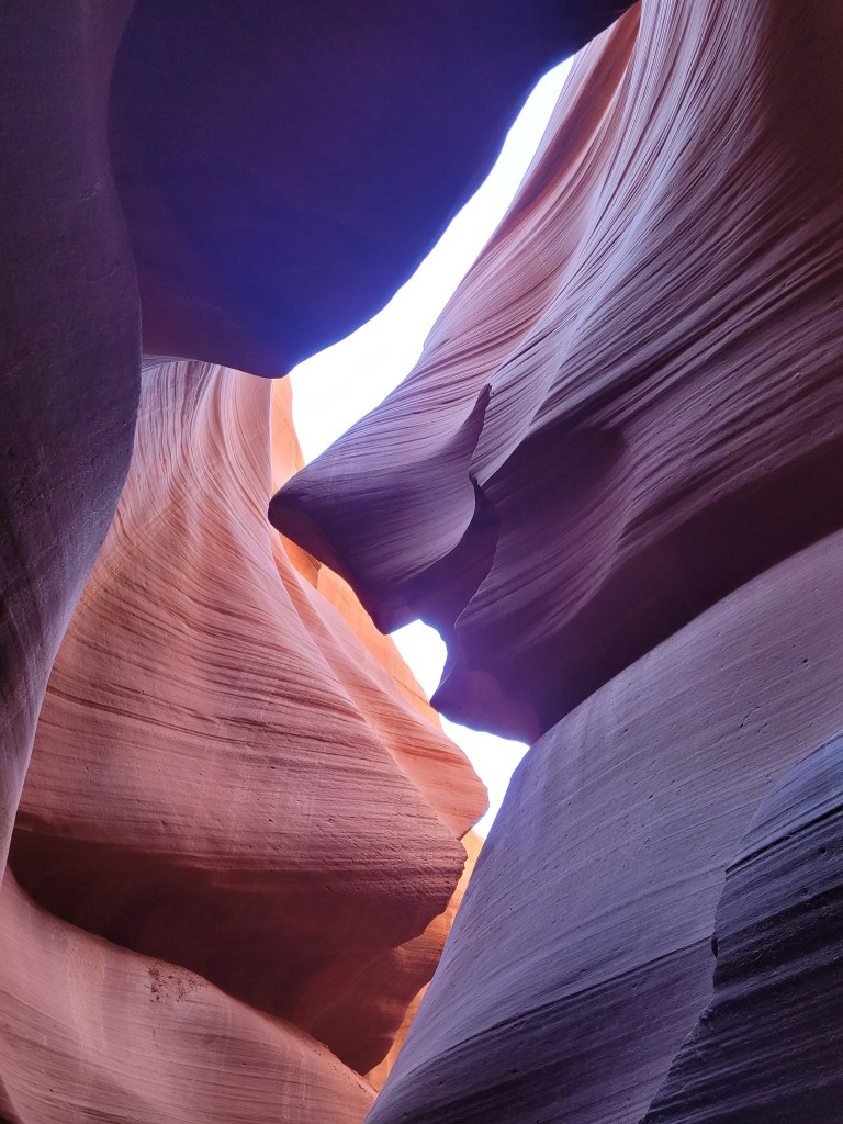
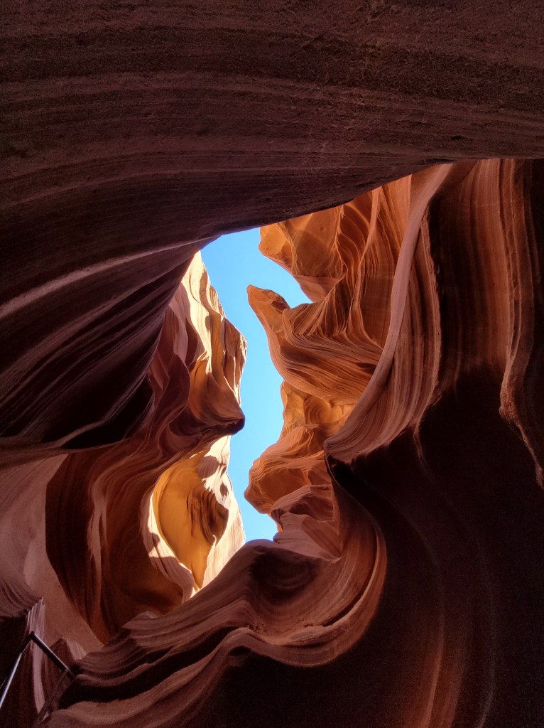
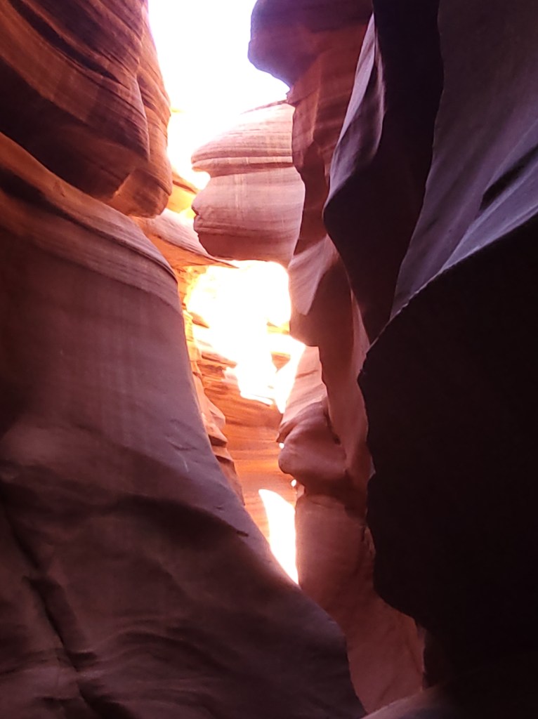
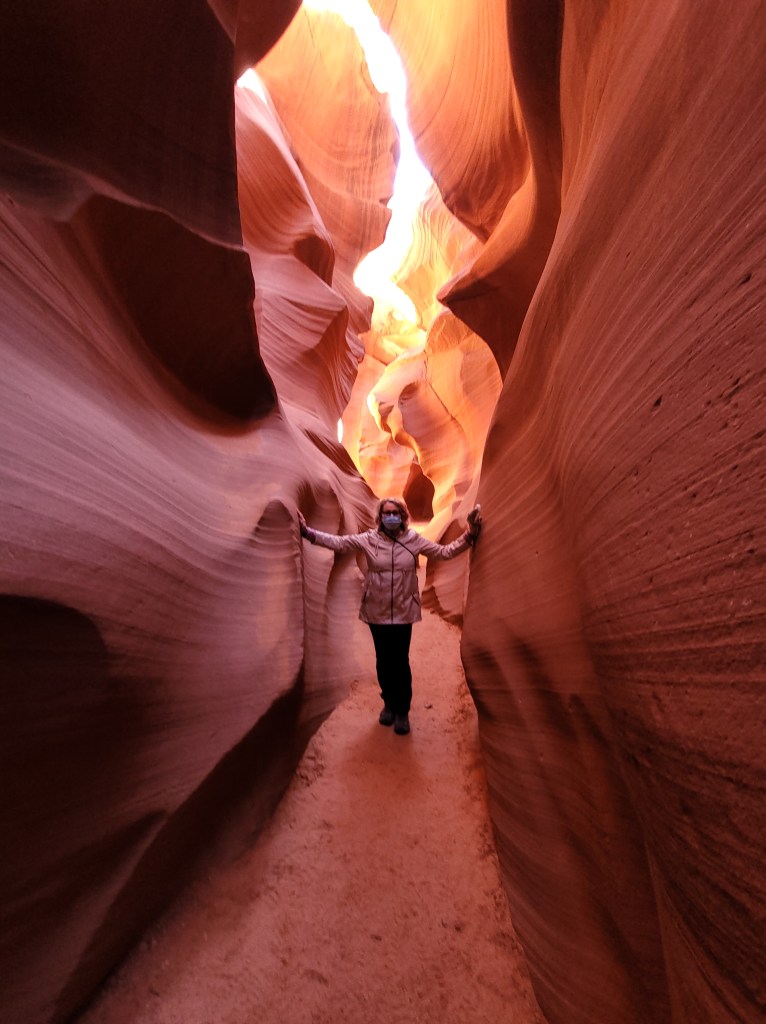
After breakfast, I headed to Antelope Canyon. The canyon was formed by the erosion of sandstone due to flash flooding. Water picks up speed and sand as it rushes through the narrow passageways. Over time the passageways eroded, deepening the corridors and smoothing the edges to form flowing shapes. There was a basketball sized boulder rammed into the canyon wall about 4 feet off the canyon floor. When we asked about it, our guide said they figure the boulder got rammed in during a flash flood.
There are two tours: Upper and Lower. I took the Lower Canyon tour. Both are on Navajo land and run by the Navajo Nation. One can only visit through a guided tour, partly because rains can quickly flood it. Rain falling dozens of miles away can funnel into the canyon with little notice. An alert system is in place to warn people down the line. In 1997 the warning was not heeded. It was hardly raining when 11 tourists and a guide went into the canyon. However, a thunderstorm dumped a huge amount of precipitation 7 miles (11 km) upstream. Only the guide survived.
There were only 4 of us with one guide. He took each of our cell phones and adjusted them so we would get the most natural coloured pictures. There is little light in the 120 foot (36.5 m) slot canyon so pictures lose their brilliance. He even took our phones and took some amazing photos at angles we would never have spotted. OH MY GOD! It was amazing! We could see exactly how the wind and water shaped the rocks. Some had whimsical shapes, like the windswept lady, the sea horse, Donald Trump, and a smiling shark.
Everyone came out of the canyon smiling and exuberant. It was the tour of a lifetime!
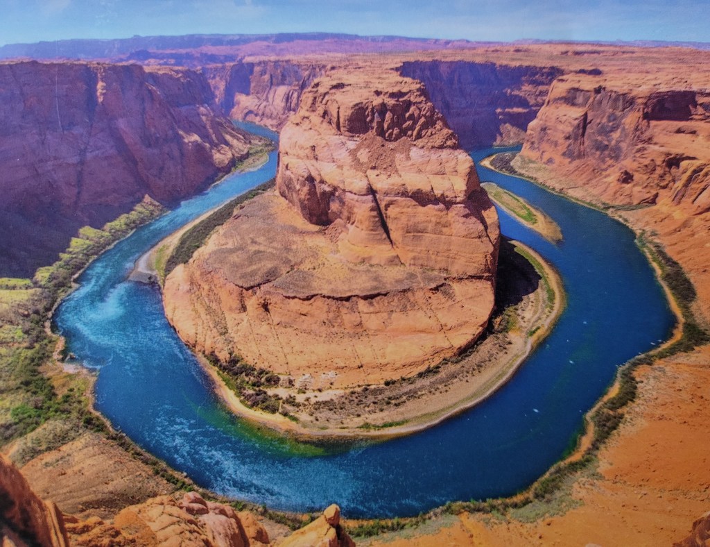
I was going to go to Horseshoe Bend, but the guide said the water levels were so low that the island looking chunk of rock at the head of the horseshoe was now surrounded by mud. Considering one has to pay to enter to see it, he recommended it was not worth it. I took a picture of a picture instead. I headed back into town instead.
I never noticed how close the hotel was to the Glen Canyon Dam until I was driving back. There was a hiking trail right across the road leading all the way to the dam. The weather had warmed up and I still had lots of daylight left, so off I went. The trail was maybe 3-4 km round trip and over mostly flat terrain. It was also clearly marked with stones showing the way.
I went all the way to the dam, walked across the beautiful 1271 ft (387 m) open steel arch bridge to the visitor centre, only to find it closed.
On my return trip, and only a short distance from the hotel, I tripped over one of the protruding sandstone ridges and fell. I scraped my wrist and knee but otherwise felt fine. Either way, I decided to spend another night in Page. I had to take a different room, but at the same discount, so no complaints. I soaked my sore spots in the hot tub again.
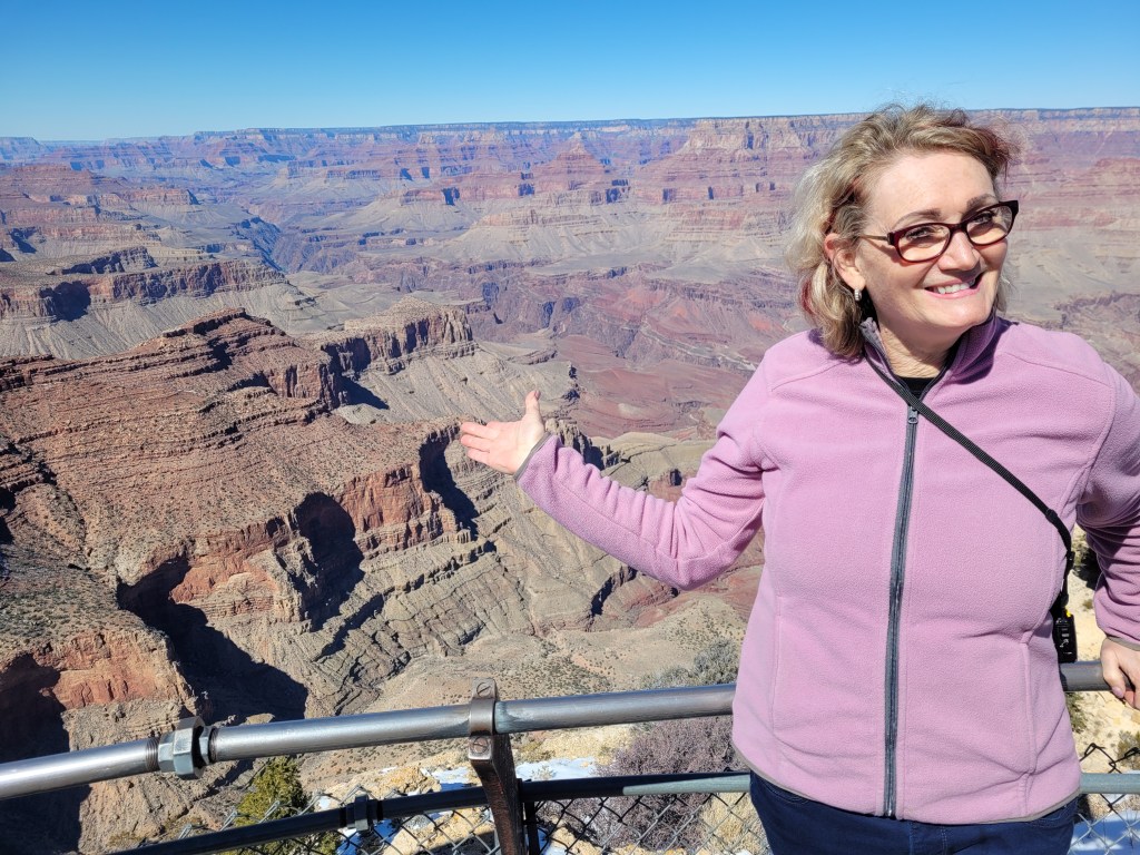
The next morning I woke up with a REALLY sore back. It felt like someone was jabbing a knife under my left shoulder blade. I guess I fell harder than I realized. Oh well, I was headed to the Grand Canyon South Rim. The one place I said I wanted to go and see, above all else, while in Arizona.
I was still at high elevations and there was still snow. I stopped at Cameron, a small Navajo village with rustic old buildings and overpriced souvenirs. I didn’t stop at all the viewing points along the road to the Grand Canyon Visitor’s Centre. The canyon lives up to its name – GRAND.
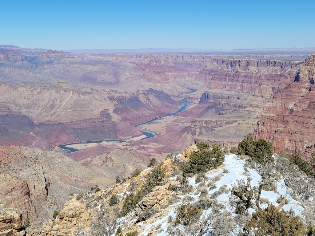
It was beautiful and I am glad I went, but I wish I had seen it before Antelope Canyon. To be honest, it was a bit of a disappointment after seeing Antelope. Also, I realized when I got home that I prefer mountains over canyons. Mountains make me feel small, like I am a grain of sand in the grand scheme of the universe. Looking down into, albeit a Grand Canyon, gave me a sense of domination. What I can only imagine the great conquerors of the world felt like. This is only my personal observation and query into my reaction to a sight that I have had on my bucket list for decades.
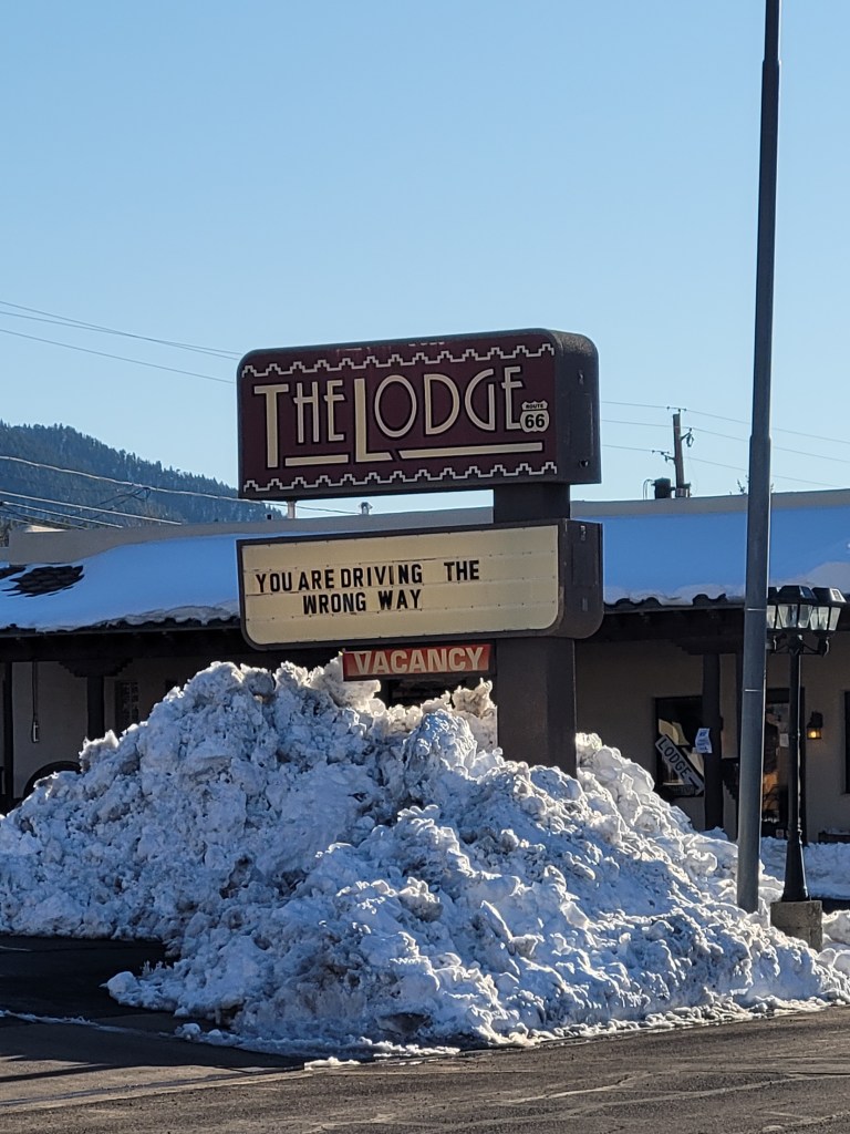
Also, my back was really sore. (could also be why I didn’t enjoy myself fully) I Googled “Chiropractors near me” and found one in Williams. I called and he said if I could be there by 5:00 he would treat me. I drove to Williams, found the doctor, had a quick adjustment, paid my $30 and started to head toward Flagstaff. I got partway out of town and realized I should take the doctor’s advice and not drive anymore tonight. I turned around and went back to Williams and found a hotel room. Where I found a dog bone under the bed and got half off my room. They also had a complimentary breakfast the next morning.
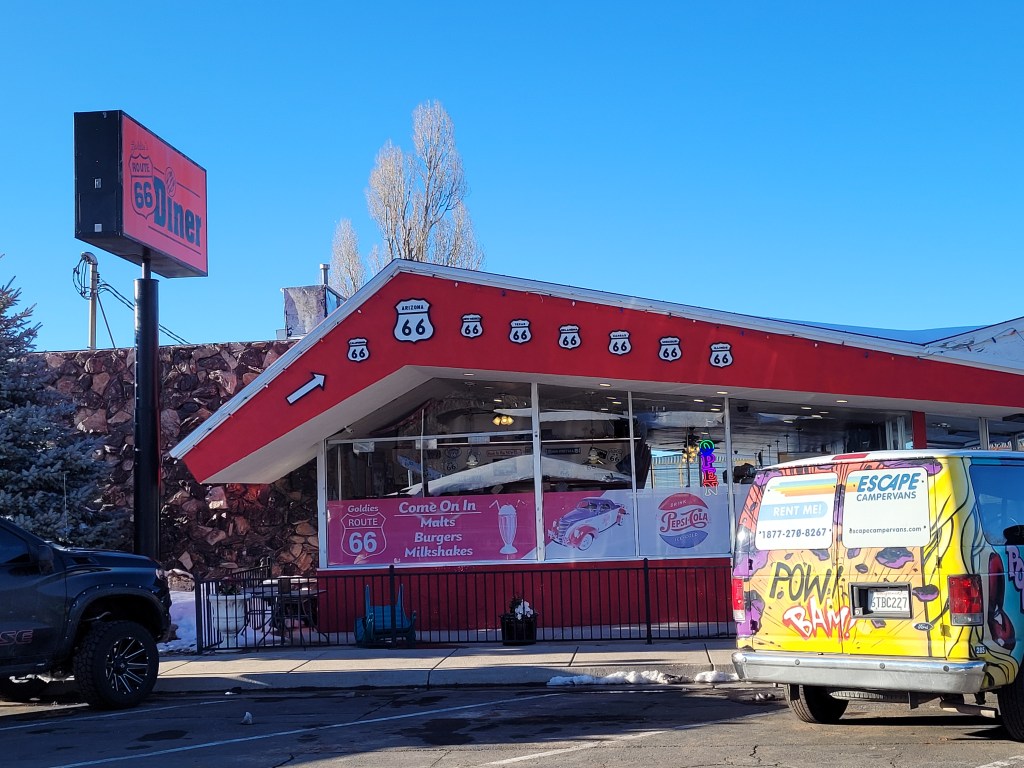
There was a Route 66 Diner directly across the street from me. I was on Route 66! Cool! Although it was later in the day, that diner got me interested to see the rest of the town, so I took a walk up one side of the street and down the other. There was LOTS of snow. It was piled up 2 meters high in places.
At times I had to walk on the street because no one had shovelled the snow off the sidewalk. The whole town had an old western theme going on. There were statues of cowboys in front of shops and saloons and many of the shops had rustic decor. An old hotel had a sign boasting it has been in business since 1891. Restaurants seemed to have beef, beef or beef on the menu.
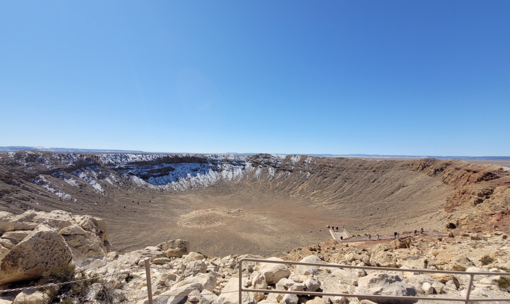
The next day I headed for Meteor Crater. As generally happens when I travel, I have a plan but get detoured by other travellers to locations I had never heard of. This was one of them. 61,000 years ago a meteor, travelling at 26,000 mph (43,000 km) slammed into the earth, near Winslow. The huge iron-nickel meteorite, estimated to be 150 ft (46 m) across, and weighing several hundred thousand tons struck the earth with an explosive force of more than 20 million tons of TNT- 150 times the Hiroshima atomic bomb.
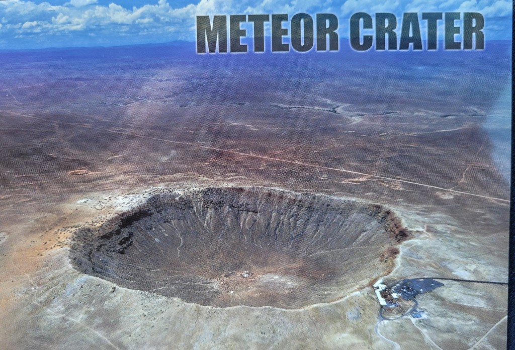
What is left is a hole a mile (1.6 km) across. The rim of the crater rises up from the desert floor. When the meteor hit it flipped the inside of the hole up and out. Think of a slow-motion picture of a stone hitting the water, and the splash up and outward. Bedrock was ejected and thrown 1-2 km away. The rim crest is being eroded by the winds across the desert. Also, the crater is being filled in by the same winds blowing sand in. Mining and NASA training only quickened the erosion. In 1963 the crater was 700 ft (213 m) deep. Today it is only 500 ft (168 m). All that said, it is still the best preserved meteor impact site in the world.
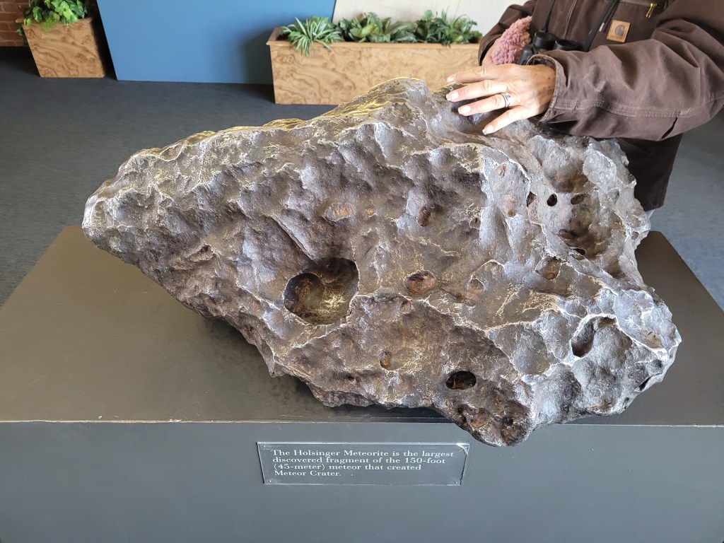
The site is privately owned by the Barringer family. Mr. Barringer was a miner and filed mining claims on the crater, hoping to find iron. He never did find the meteorite. The site has remained in the family for four generations. The only big evidence of the meteorite is a large fragment that is on display in the visitor centre. It is only about 2 ½ feet across but weighs 1409 lbs (639 kg) and is valued at over 2 million dollars. I bought a quarter-sized piece in the gift shop. It looks like an ordinary rock but will stick to a magnet. Cool toy!
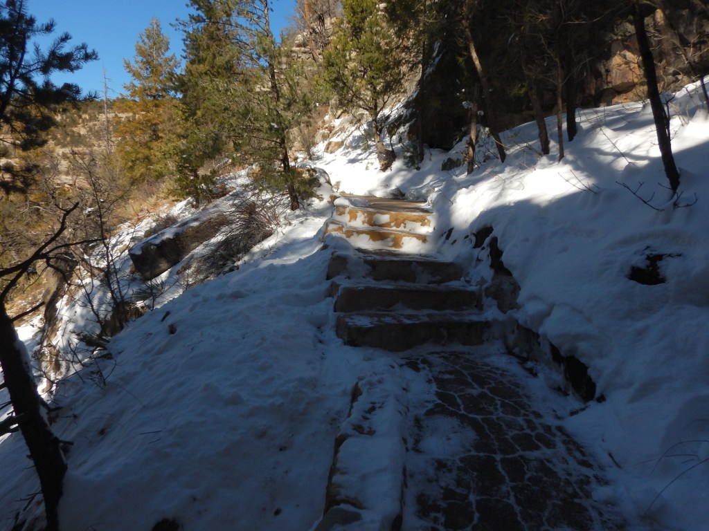
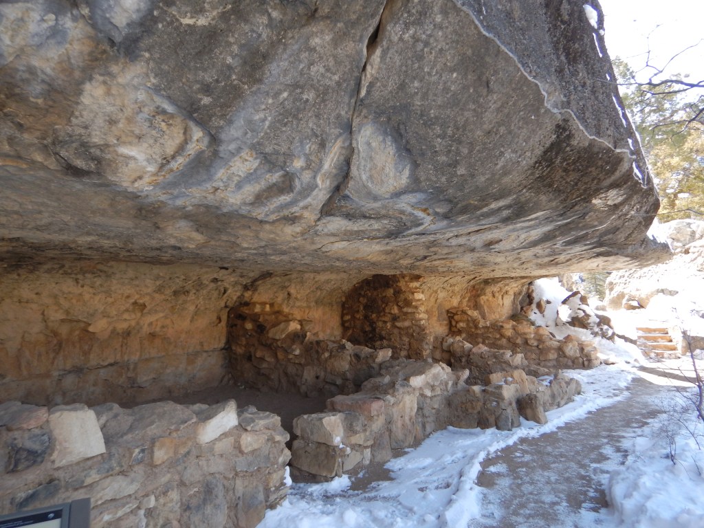
Heading back toward Flagstaff, I stopped at Walnut Canyon. It was another place recommended by fellow travellers. Walnut Canyon sits at an elevation of 6690 ft (2040 m) and drops sharply to the canyon floor.
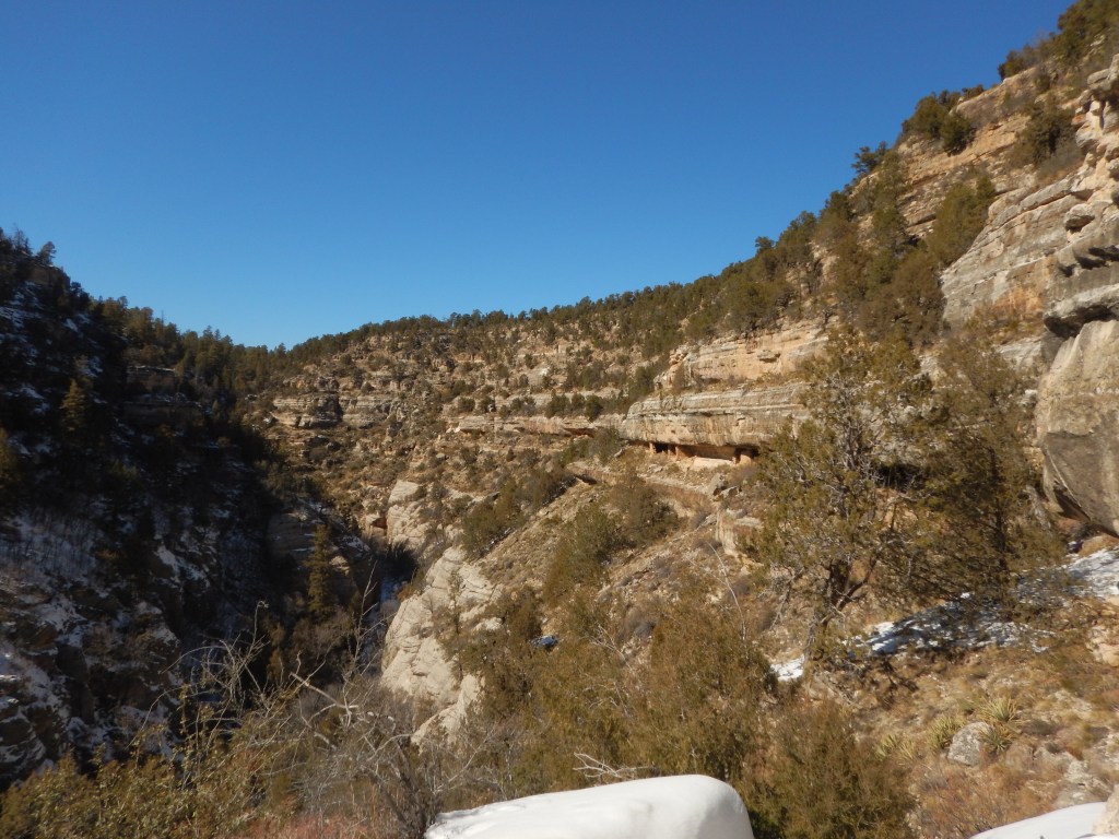
Cliff dwellers used to live in natural alcoves tucked into the cliffs about 800-900 years ago. The visitor center cautioned me that there were 736 steps taking me down 370 ft (122 m) on the mile-long round trip hike. Let’s go!
The Sinagua Indians left behind 80 cliff dwellings, on either side of the canyon. The rock alcoves provided the back wall, floor and leak-proof ceiling. No excavation was needed. They added stone walls that acted as outside walls and room dividers. They plastered them with mud to keep them sealed, insulating them from the harsh winds. They would also have retained heat in the winter.
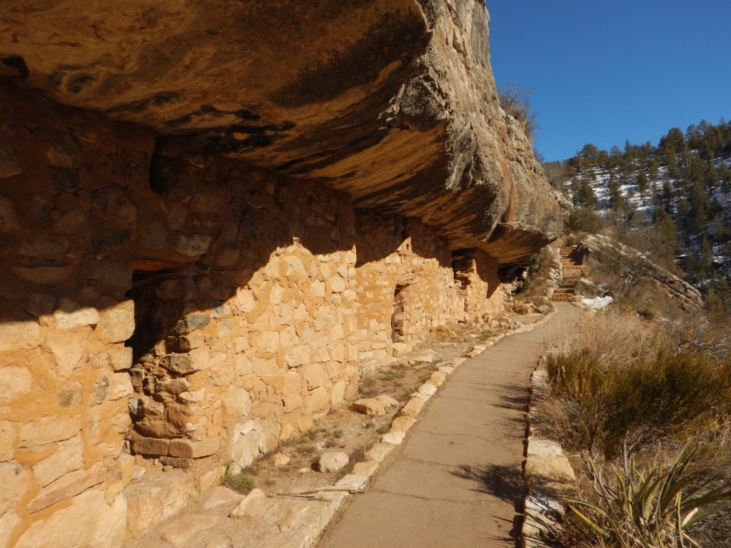
The doors were small, covered with animal skin. The fire was lit near the door with a small opening above to let out the smoke. Rooms on the shady side of the cliffs were most likely used as storage units.
Water had to be packed up from the creek in the wet months and stored in pots and jars. Snow was likely melted in the winter. They planted crops on the fertile rim of the canyon.
I chuckled thinking of little kids wanting to play with their friends on the other side of the gorge. “I’m going to Billy’s house to play. I’ll be back in 3 days.”
I headed for Scottsdale, intending to spend the night. The usual abundance of truck stops seemed to allude this stretch of highway. Before I knew it, I was in Phoenix. I pulled into a truck stop for gas and asked at the counter if I could park there for the night. Another customer at the counter overheard me. When we got outside, she told me NOT to park there, as it was a dangerous area. She suggested a different truck stop a few miles away. OK! I guess I’m moving on. I found the other truck stop, pulled in beside a van, and bedded down for the night. At 6:00 am the next morning I was awakened by the security guard telling me I had to move. The van had obscured the sign saying No Overnight Parking. Oops! No worries, I moved closer to the building, had my shower, bought a coffee then carried on.
The day before I was to return the car I went back to Goldfield Ghost Town. There were a few things that I wanted to check out that I didn’t on the first trip. For instance, the high noon shoot-out, with characters dressed in appropriate garb. It is LOUD!
I also wanted to get a tour of the brothel. For $5 it was well worth it! There are no windows in the brothel. Not to protect the virtue of the girls, but to protect their assets. (Pun intended) They were the richest people in town. The girls started as young as 12-14 years old. This may sound shocking but consider that 40 years old was OLD at the time. If a girl did get pregnant, abortions were not an option. They were available but were almost always a death sentence – to the girl. The madam usually agreed to take care of the girl and her baby in exchange for the child working for the madam later on. Girls did what girls did and boys would do chores, guard the door, etc.
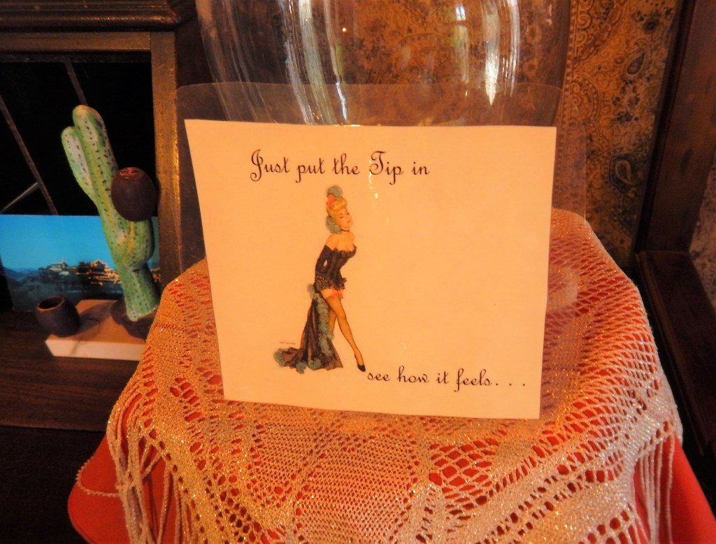
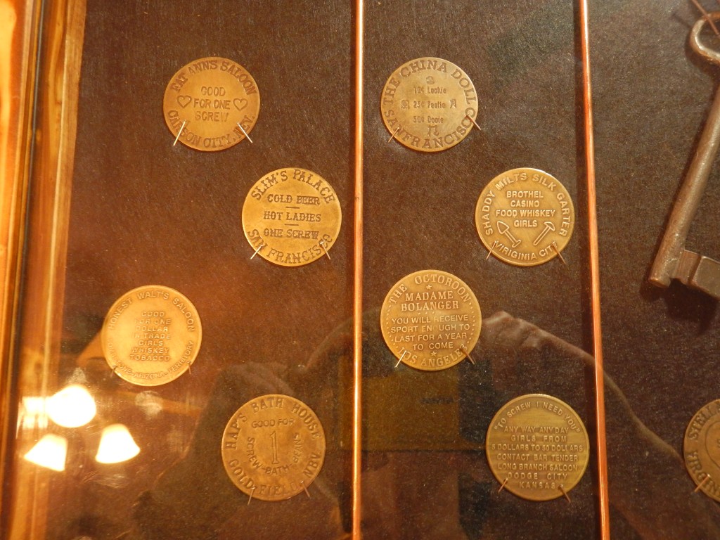
There were “Hooker coins” that could be purchased for varying services. The girls always had a bowl of water for the men to wash with prior to having sex. Unknown to the men, there was whiskey in the water. If they had a STD the whiskey would burn their privates, at which point the girl would call the guard and the man would be escorted out – no refunds.
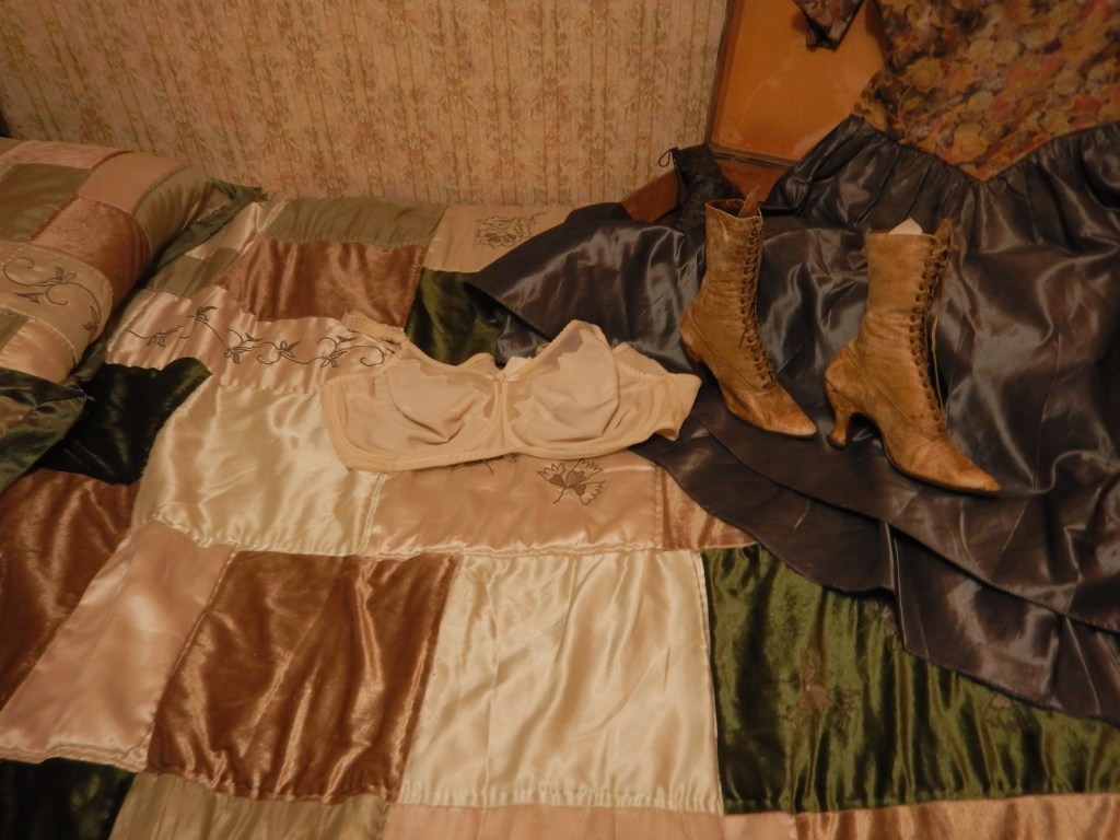
There were clothes laid out on one of the beds. The boots were tiny but the bra was huge. Priorities! Apparently, girls used to bind their feet, similar to Japanese women.
The term “shot” and “shot glass” were explained. If a man did not have sufficient funds for a drink, he could sell a bullet (a shot). The bartender would put the shot in a glass (shot glass) and pour whiskey until the tip of the bullet was covered. The bartender kept the bullet and the cowboy got the whiskey. Small bullet, small shot. Big bullet, big shot.
When I got back to Gold Canyon, Jim and I took a brother / sister trip to Old Town Scottsdale and into downtown Phoenix.
We wandered around through the rustic shops looking at all the trinkets being sold. We laughed when we came to a shop selling authentic Navajo items which was run by a Chinese woman.
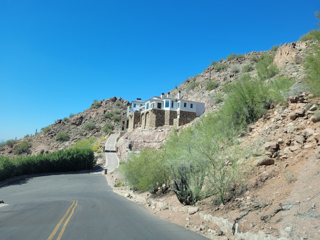
We took a drive up into the hills to check out some of the expensive resorts and homes. Snob Hill took on a whole new meaning.
The road trip was over. Back at Jim’s place, I got the news that my other brother, Joe, was dying. I flew back to Canada on Friday. It took Jim a couple extra days to get a flight and book a Covid test. Joe died the following Thursday. How quickly life can go from fun and games to sorrow.

Leave a comment